

(ден 12) Черни Осъм - Кърнаре - Златица - Панагюрище
A cycling route starting in Troyan Municipality, Lovech, Bulgaria.
Overview
About this route
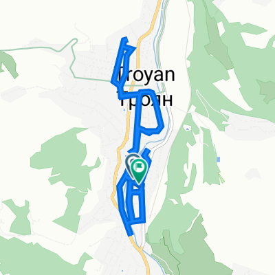
(ден 12) Черни Осъм - Кърнаре - Златица - Панагюрище
- -:--
- Duration
- 141.8 km
- Distance
- 2,261 m
- Ascent
- 2,244 m
- Descent
- ---
- Avg. speed
- ---
- Max. altitude

Route quality
Waytypes & surfaces along the route
Waytypes
Busy road
119.2 km
(84 %)
Road
12.8 km
(9 %)
Surfaces
Paved
97.5 km
(69 %)
Unpaved
4.8 km
(3 %)
Asphalt
97.3 km
(69 %)
Gravel
4.8 km
(3 %)
Continue with Bikemap
Use, edit, or download this cycling route
You would like to ride (ден 12) Черни Осъм - Кърнаре - Златица - Панагюрище or customize it for your own trip? Here is what you can do with this Bikemap route:
Free features
- Save this route as favorite or in collections
- Copy & plan your own version of this route
- Split it into stages to create a multi-day tour
- Sync your route with Garmin or Wahoo
Premium features
Free trial for 3 days, or one-time payment. More about Bikemap Premium.
- Navigate this route on iOS & Android
- Export a GPX / KML file of this route
- Create your custom printout (try it for free)
- Download this route for offline navigation
Discover more Premium features.
Get Bikemap PremiumFrom our community
Other popular routes starting in Troyan Municipality
 улица „Захари Стоянов“ 3, Троян to улица „Захари Стоянов“ 10, Троян
- Distance
- 13.3 km
- Ascent
- 49 m
- Descent
- 93 m
- Location
- Troyan Municipality, Lovech, Bulgaria
 (ден 12) Черни Осъм - Кърнаре - Златица - Панагюрище
- Distance
- 141.8 km
- Ascent
- 2,261 m
- Descent
- 2,244 m
- Location
- Troyan Municipality, Lovech, Bulgaria
 Orešak - Černa Mogyla
- Distance
- 20.5 km
- Ascent
- 1,229 m
- Descent
- 108 m
- Location
- Troyan Municipality, Lovech, Bulgaria
 Borima-Lesidren-Golyama_Zhelyazna-Toplya_cave-Borima
- Distance
- 50 km
- Ascent
- 852 m
- Descent
- 855 m
- Location
- Troyan Municipality, Lovech, Bulgaria
 bikleme
- Distance
- 18.3 km
- Ascent
- 1,304 m
- Descent
- 296 m
- Location
- Troyan Municipality, Lovech, Bulgaria
 Троян-София
- Distance
- 173.7 km
- Ascent
- 2,130 m
- Descent
- 1,925 m
- Location
- Troyan Municipality, Lovech, Bulgaria
 Беклемето-х.Козя стена
- Distance
- 8.3 km
- Ascent
- 254 m
- Descent
- 247 m
- Location
- Troyan Municipality, Lovech, Bulgaria
 Tour of Bulgaria - III. Stage - Troyan - Gabrovo
- Distance
- 99.6 km
- Ascent
- 632 m
- Descent
- 582 m
- Location
- Troyan Municipality, Lovech, Bulgaria
Open it in the app