

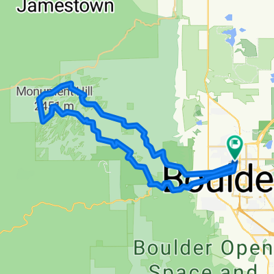
Old Stage—Hygiene route near Boulder
A cycling route starting in Boulder, Colorado, United States.
Overview
About this route
- 2 h
- Duration
- 50.6 km
- Distance
- 622 m
- Ascent
- 620 m
- Descent
- 25.3 km/h
- Avg. speed
- ---
- Max. altitude

Route quality
Waytypes & surfaces along the route
Waytypes
Road
22.8 km
(45 %)
Cycleway
12.7 km
(25 %)
Surfaces
Paved
43 km
(85 %)
Unpaved
3.5 km
(7 %)
Asphalt
39 km
(77 %)
Loose gravel
2.5 km
(5 %)
Continue with Bikemap
Use, edit, or download this cycling route
You would like to ride Old Stage—Hygiene route near Boulder or customize it for your own trip? Here is what you can do with this Bikemap route:
Free features
- Save this route as favorite or in collections
- Copy & plan your own version of this route
- Sync your route with Garmin or Wahoo
Premium features
Free trial for 3 days, or one-time payment. More about Bikemap Premium.
- Navigate this route on iOS & Android
- Export a GPX / KML file of this route
- Create your custom printout (try it for free)
- Download this route for offline navigation
Discover more Premium features.
Get Bikemap PremiumFrom our community
Other popular routes starting in Boulder
 Lengthy bike tour through Boulder
- Distance
- 45.2 km
- Ascent
- 275 m
- Descent
- 277 m
- Location
- Boulder, Colorado, United States
 20km North Boulder
- Distance
- 21.2 km
- Ascent
- 198 m
- Descent
- 197 m
- Location
- Boulder, Colorado, United States
 Boulder - Denver crono
- Distance
- 54.3 km
- Ascent
- 425 m
- Descent
- 432 m
- Location
- Boulder, Colorado, United States
 Flag-Gross-Coal-BC
- Distance
- 80.3 km
- Ascent
- 1,757 m
- Descent
- 1,757 m
- Location
- Boulder, Colorado, United States
 B180
B180- Distance
- 18.5 km
- Ascent
- 79 m
- Descent
- 79 m
- Location
- Boulder, Colorado, United States
 Reservoirs Loop
- Distance
- 53.5 km
- Ascent
- 315 m
- Descent
- 338 m
- Location
- Boulder, Colorado, United States
 mapleton to gold hill
- Distance
- 39.9 km
- Ascent
- 1,031 m
- Descent
- 1,023 m
- Location
- Boulder, Colorado, United States
 boulder seven hills
- Distance
- 35.7 km
- Ascent
- 1,000 m
- Descent
- 1,066 m
- Location
- Boulder, Colorado, United States
Open it in the app