
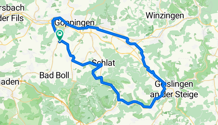
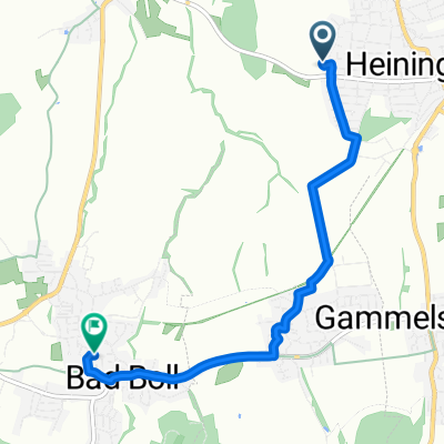
filstalroute
A cycling route starting in Heiningen, Baden-Wurttemberg, Germany.
Overview
About this route
- -:--
- Duration
- 52.9 km
- Distance
- 366 m
- Ascent
- 366 m
- Descent
- ---
- Avg. speed
- ---
- Max. altitude
Route quality
Waytypes & surfaces along the route
Waytypes
Quiet road
20.4 km
(38 %)
Track
11.1 km
(21 %)
Surfaces
Paved
37.3 km
(70 %)
Unpaved
4.1 km
(8 %)
Asphalt
32.6 km
(62 %)
Paved (undefined)
3.8 km
(7 %)
Continue with Bikemap
Use, edit, or download this cycling route
You would like to ride filstalroute or customize it for your own trip? Here is what you can do with this Bikemap route:
Free features
- Save this route as favorite or in collections
- Copy & plan your own version of this route
- Sync your route with Garmin or Wahoo
Premium features
Free trial for 3 days, or one-time payment. More about Bikemap Premium.
- Navigate this route on iOS & Android
- Export a GPX / KML file of this route
- Create your custom printout (try it for free)
- Download this route for offline navigation
Discover more Premium features.
Get Bikemap PremiumFrom our community
Other popular routes starting in Heiningen
 filstalroute
- Distance
- 52.9 km
- Ascent
- 366 m
- Descent
- 366 m
- Location
- Heiningen, Baden-Wurttemberg, Germany
 Heiningen am Fuß der Alb
- Distance
- 30.5 km
- Ascent
- 383 m
- Descent
- 385 m
- Location
- Heiningen, Baden-Wurttemberg, Germany
 Leichte Voralbroute
- Distance
- 20.4 km
- Ascent
- 186 m
- Descent
- 183 m
- Location
- Heiningen, Baden-Wurttemberg, Germany
 Heiningen am Fuß der Alb
- Distance
- 30.5 km
- Ascent
- 326 m
- Descent
- 326 m
- Location
- Heiningen, Baden-Wurttemberg, Germany
 Reuschstraße 54, Heiningen nach Hohenstaufenstraße 34, Göppingen
- Distance
- 11.5 km
- Ascent
- 95 m
- Descent
- 152 m
- Location
- Heiningen, Baden-Wurttemberg, Germany
 Bürgersee
- Distance
- 36.1 km
- Ascent
- 221 m
- Descent
- 212 m
- Location
- Heiningen, Baden-Wurttemberg, Germany
 Mörikestraße 142, Heiningen nach Untere Breite 19, Bad Boll
- Distance
- 4.6 km
- Ascent
- 61 m
- Descent
- 34 m
- Location
- Heiningen, Baden-Wurttemberg, Germany
 MTB Heiningen - Bossler - Schloss Filseck
- Distance
- 46.3 km
- Ascent
- 647 m
- Descent
- 648 m
- Location
- Heiningen, Baden-Wurttemberg, Germany
Open it in the app