

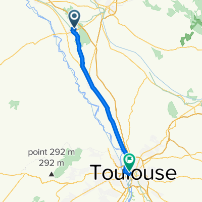
1 Etapa Montech-Vazerac Camping Latopie
A cycling route starting in Montech, Occitanie, France.
Overview
About this route
- -:--
- Duration
- 38.9 km
- Distance
- 154 m
- Ascent
- 139 m
- Descent
- ---
- Avg. speed
- ---
- Max. altitude

Route quality
Waytypes & surfaces along the route
Waytypes
Quiet road
10.1 km
(26 %)
Path
8.5 km
(22 %)
Surfaces
Paved
8.2 km
(21 %)
Asphalt
8.2 km
(21 %)
Undefined
30.7 km
(79 %)
Continue with Bikemap
Use, edit, or download this cycling route
You would like to ride 1 Etapa Montech-Vazerac Camping Latopie or customize it for your own trip? Here is what you can do with this Bikemap route:
Free features
- Save this route as favorite or in collections
- Copy & plan your own version of this route
- Sync your route with Garmin or Wahoo
Premium features
Free trial for 3 days, or one-time payment. More about Bikemap Premium.
- Navigate this route on iOS & Android
- Export a GPX / KML file of this route
- Create your custom printout (try it for free)
- Download this route for offline navigation
Discover more Premium features.
Get Bikemap PremiumFrom our community
Other popular routes starting in Montech
 Day 2 - Montech - Valence d'Agen
- Distance
- 42.1 km
- Ascent
- 29 m
- Descent
- 76 m
- Location
- Montech, Occitanie, France
 escatalens monbeton montech escatalens
- Distance
- 26 km
- Ascent
- 33 m
- Descent
- 32 m
- Location
- Montech, Occitanie, France
 Montech-Deyme Camping des violettes
- Distance
- 63.9 km
- Ascent
- 91 m
- Descent
- 39 m
- Location
- Montech, Occitanie, France
 escatalens castelsarazin escatalens par canal
- Distance
- 25.9 km
- Ascent
- 24 m
- Descent
- 25 m
- Location
- Montech, Occitanie, France
 escatalens st porquier la villedieu du temple
- Distance
- 27.8 km
- Ascent
- 39 m
- Descent
- 40 m
- Location
- Montech, Occitanie, France
 Montech - Toulouse
- Distance
- 45.5 km
- Ascent
- 63 m
- Descent
- 27 m
- Location
- Montech, Occitanie, France
 Montech / Toulouse
- Distance
- 45.9 km
- Ascent
- 98 m
- Descent
- 56 m
- Location
- Montech, Occitanie, France
 11ème étape
- Distance
- 94 km
- Ascent
- 166 m
- Descent
- 42 m
- Location
- Montech, Occitanie, France
Open it in the app