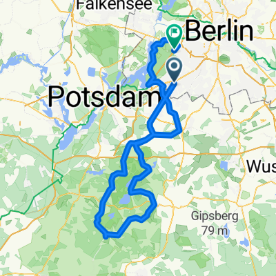
Dobbrikow andersrum plus Caputh
A cycling route starting in Zehlendorf, State of Berlin, Germany.
Overview
About this route
Eine der zahlreichen Dobbrikow-Variationen.
Hier abgerundet durch die recht reizvolle Fahrt über Wildenbruch nach Caputh - zwischen Fresdorf und Caputh gibt es übrigens fast durchgehend einen exzellenten Radweg auf der östlichen Straßenseite. Der Autoverkehr ist aber i.a. ziemlich harmlos...
Zwischen Caputh und Potsdam ist hingegen der RAdweg ratsam, er ist a) besser als die Straße (die hat den Charme der DDR-Autobahnen) und b) ist diese bei gutem Wetter voll von Dödeln in Blechkisten.
- -:--
- Duration
- 110.3 km
- Distance
- 184 m
- Ascent
- 182 m
- Descent
- ---
- Avg. speed
- 59 m
- Max. altitude
Route quality
Waytypes & surfaces along the route
Waytypes
Road
31.3 km
(28 %)
Busy road
20.3 km
(18 %)
Surfaces
Paved
93.9 km
(85 %)
Unpaved
3.4 km
(3 %)
Asphalt
81.4 km
(74 %)
Paving stones
8.6 km
(8 %)
Route highlights
Points of interest along the route
Point of interest after 48.3 km
Die Scheune - günstiges Mittagessen inmitten zahlreicher Mofafahrerinnen und -fahrer...
Continue with Bikemap
Use, edit, or download this cycling route
You would like to ride Dobbrikow andersrum plus Caputh or customize it for your own trip? Here is what you can do with this Bikemap route:
Free features
- Save this route as favorite or in collections
- Copy & plan your own version of this route
- Split it into stages to create a multi-day tour
- Sync your route with Garmin or Wahoo
Premium features
Free trial for 3 days, or one-time payment. More about Bikemap Premium.
- Navigate this route on iOS & Android
- Export a GPX / KML file of this route
- Create your custom printout (try it for free)
- Download this route for offline navigation
Discover more Premium features.
Get Bikemap PremiumFrom our community
Other popular routes starting in Zehlendorf
 Berliner Mauerweg
- Distance
- 172.8 km
- Ascent
- 175 m
- Descent
- 181 m
- Location
- Zehlendorf, State of Berlin, Germany
 Zehlendorf -> Trebbin
- Distance
- 72.6 km
- Ascent
- 96 m
- Descent
- 95 m
- Location
- Zehlendorf, State of Berlin, Germany
 Radtour Südlich von Berlin
- Distance
- 68.2 km
- Ascent
- 117 m
- Descent
- 117 m
- Location
- Zehlendorf, State of Berlin, Germany
 S Zehlendorf -> Tremsdorf -> Caputh -> Auerbachtunnel
- Distance
- 65.4 km
- Ascent
- 258 m
- Descent
- 245 m
- Location
- Zehlendorf, State of Berlin, Germany
 Dahlem Route
- Distance
- 15.8 km
- Ascent
- 49 m
- Descent
- 52 m
- Location
- Zehlendorf, State of Berlin, Germany
 RTF 24. Eichh. 2. Runde
- Distance
- 40.5 km
- Ascent
- 112 m
- Descent
- 116 m
- Location
- Zehlendorf, State of Berlin, Germany
 Dobbrikow andersrum
- Distance
- 111.2 km
- Ascent
- 139 m
- Descent
- 133 m
- Location
- Zehlendorf, State of Berlin, Germany
 Grunewaldrund
- Distance
- 25.9 km
- Ascent
- 305 m
- Descent
- 301 m
- Location
- Zehlendorf, State of Berlin, Germany
Open it in the app


