

uña mochales
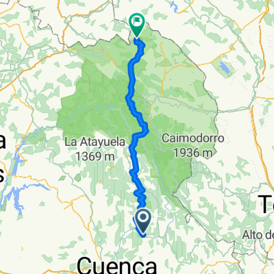
A cycling route starting in Uña, Castille-La Mancha, Spain.
Overview
About this route
- -:--
- Duration
- 135.9 km
- Distance
- 1,945 m
- Ascent
- 1,840 m
- Descent
- ---
- Avg. speed
- ---
- Max. altitude

Route quality
Waytypes & surfaces along the route
Waytypes
Road
53 km
(39 %)
Track
51.6 km
(38 %)
Surfaces
Paved
13.6 km
(10 %)
Unpaved
28.5 km
(21 %)
Gravel
19 km
(14 %)
Asphalt
13.6 km
(10 %)
Continue with Bikemap
Use, edit, or download this cycling route
You would like to ride uña mochales or customize it for your own trip? Here is what you can do with this Bikemap route:
Free features
- Save this route as favorite or in collections
- Copy & plan your own version of this route
- Split it into stages to create a multi-day tour
- Sync your route with Garmin or Wahoo
Premium features
Free trial for 3 days, or one-time payment. More about Bikemap Premium.
- Navigate this route on iOS & Android
- Export a GPX / KML file of this route
- Create your custom printout (try it for free)
- Download this route for offline navigation
Discover more Premium features.
Get Bikemap PremiumFrom our community
Other popular routes starting in Uña
 Tramo Maraton Sendas de Cuenca 2015
- Distance
- 36.6 km
- Ascent
- 232 m
- Descent
- 397 m
- Location
- Uña, Castille-La Mancha, Spain
 Ruta 29 : Serrania de Cuenca - etapa 2
- Distance
- 60 km
- Ascent
- 635 m
- Descent
- 426 m
- Location
- Uña, Castille-La Mancha, Spain
 Sendero PR-CU 37 (CGSC)
- Distance
- 11 km
- Ascent
- 332 m
- Descent
- 332 m
- Location
- Uña, Castille-La Mancha, Spain
 Tramo I Maraton Sendas de Cuenca. Buenache de la Sierra.
- Distance
- 25.9 km
- Ascent
- 641 m
- Descent
- 570 m
- Location
- Uña, Castille-La Mancha, Spain
 Laguna de Uña
- Distance
- 3.3 km
- Ascent
- 90 m
- Descent
- 87 m
- Location
- Uña, Castille-La Mancha, Spain
 Cuenca — El Júcar: Villaba de la Sierra - Tragacete
- Distance
- 37.7 km
- Ascent
- 239 m
- Descent
- 269 m
- Location
- Uña, Castille-La Mancha, Spain
 uña mochales
- Distance
- 135.9 km
- Ascent
- 1,945 m
- Descent
- 1,840 m
- Location
- Uña, Castille-La Mancha, Spain
 Uña BTT Mochales
- Distance
- 146.4 km
- Ascent
- 1,974 m
- Descent
- 2,131 m
- Location
- Uña, Castille-La Mancha, Spain
Open it in the app