- 78.5 km
- 1,140 m
- 1,131 m
- Mühlacker, Baden-Wurttemberg, Germany
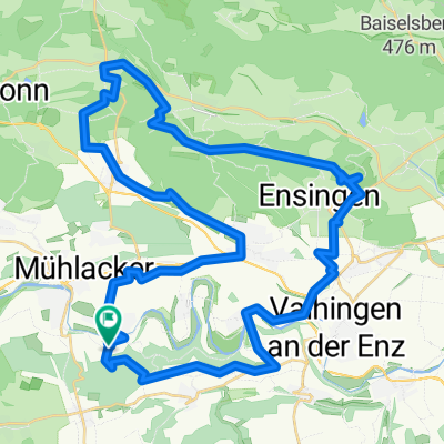
Mühlacker_Oberderdingen_Zabergäu_Stromberg_Mühlacker
A cycling route starting in Mühlacker, Baden-Wurttemberg, Germany.
Overview
About this route
We did the tour as a pair without any specific occasion, without a specific goal, just like that. The terrain is partly flat without significant inclines. Only the ascents from Kürnbach to Ochsenburg and then the inclines from Weiler a.d.Z. over the Strombergrücken (400-450m NN) to Häfnerhaslach and to Füllmenbacherhof are noteworthy. Beautiful views at the 'Derdinger Horn' and over the 'Mettertal / Füllmenbacher Hof'. Also noteworthy is the town center of Oberderdingen with the 'Amthof', the town center of Kürnbach (church open) and the fortified church complex in Lienzingen at the end of the tour. In Zaberfeld, there are two recreational lakes (Ehmentsklinge, Katzenbachsee), which are both artificial rainwater retention basins. The paths are mostly paved or gravel; a few unpaved forest paths can be traveled (mountain bike trail).
- -:--
- Duration
- 53.8 km
- Distance
- 598 m
- Ascent
- 598 m
- Descent
- ---
- Avg. speed
- ---
- Max. altitude
created this 15 years ago
Route quality
Waytypes & surfaces along the route
Waytypes
Track
31.2 km
(58 %)
Quiet road
8.1 km
(15 %)
Surfaces
Paved
23.7 km
(44 %)
Unpaved
24.2 km
(45 %)
Asphalt
19.9 km
(37 %)
Gravel
16.1 km
(30 %)
Route highlights
Points of interest along the route
Point of interest after 0.1 km
Kinderspielplatz am Enztalradweg
Point of interest after 2.4 km
Waldensermuseum. (Waldenser - Glaubensgruppierung aus dem Piemont eingewandert im 17.Jh.)
Point of interest after 13.2 km
Stromberg-Camping, Campingplatz, kleines Freibad (öffentl.)
Point of interest after 15.8 km
Waldspielplatz, Grillhütte, am Derdinger Horn. Herrliche Aussicht auf das Weissachtal, Büschlehof, Knittlingen
Point of interest after 16.5 km
Aussichtspunkt Derdinger Horn. Blick auf Stromberg und Kraichgau.
Point of interest after 18.3 km
Oberderdingen, Amthof, Fachwerk
Point of interest after 23.1 km
Kürnbach, Kirche geöffnet.
Point of interest after 23.8 km
Minigolfplatz, Imbiss
Point of interest after 31.5 km
Badesee "Ehmetsklinge"
Point of interest after 34.3 km
Badesee "Katzenbachsee"
Point of interest after 38.8 km
Schöne Aussicht
Point of interest after 49.2 km
Kirchenburganlage, Fachwerkdorf
Point of interest after 50 km
Liebfrauenkirche aus dem 15.Jh.
Continue with Bikemap
Use, edit, or download this cycling route
You would like to ride Mühlacker_Oberderdingen_Zabergäu_Stromberg_Mühlacker or customize it for your own trip? Here is what you can do with this Bikemap route:
Free features
- Save this route as favorite or in collections
- Copy & plan your own version of this route
- Sync your route with Garmin or Wahoo
Premium features
Free trial for 3 days, or one-time payment. More about Bikemap Premium.
- Navigate this route on iOS & Android
- Export a GPX / KML file of this route
- Create your custom printout (try it for free)
- Download this route for offline navigation
Discover more Premium features.
Get Bikemap PremiumFrom our community
Other popular routes starting in Mühlacker
- Abendrunde lars
- Kloster-Route
- 24.8 km
- 298 m
- 296 m
- Mühlacker, Baden-Wurttemberg, Germany
- Eselsburg Runde 35km
- 35.1 km
- 288 m
- 288 m
- Mühlacker, Baden-Wurttemberg, Germany
- Café Max
- 38.9 km
- 289 m
- 290 m
- Mühlacker, Baden-Wurttemberg, Germany
- Waldenser-Tour
- 38.6 km
- 414 m
- 414 m
- Mühlacker, Baden-Wurttemberg, Germany
- Lomersheim-Rosswag-Illingen-Ensingen-Zaisersweier-Lienzingen und zurück
- 48.1 km
- 468 m
- 468 m
- Mühlacker, Baden-Wurttemberg, Germany
- Eppinger Linien von KURTI
- 47.8 km
- 568 m
- 568 m
- Mühlacker, Baden-Wurttemberg, Germany
- Kurze Ausfahrt durch Niefern-Öschelbronn
- 5.5 km
- 26 m
- 16 m
- Mühlacker, Baden-Wurttemberg, Germany
Open it in the app


