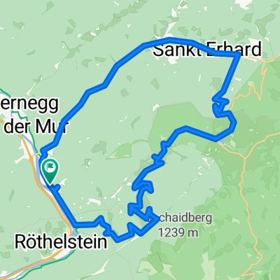
Ochsentour Teichalm - Sommeralm
A cycling route starting in Röthelstein, Styria, Austria.
Overview
About this route
Die Radtour für motivierte Radfahrer führt von der Teichalm über die Sommeralm, bis hinunter nach Gasen, über das Strassegg nach Breitenau und wieder hinauf auf die Teichalm.
Genießen Sie die wunderbaren Ausblicke und nutzen Sie die Gelegenheit, auf dem Weg in den einen oder anderen Berggasthof einzukehrern oder das bekannte "Huab'n" Freilichttheater" zu besuchen.
Wieder angekommen auf der Teichalm habe Sie die Möglichkeit, ihre Füße in das kühle Nass des Teichalmsees zu tauchen und sich eine kurze Erfrischung zu gönnen.
- -:--
- Duration
- 38 km
- Distance
- 1,137 m
- Ascent
- 1,137 m
- Descent
- ---
- Avg. speed
- ---
- Avg. speed
Route quality
Waytypes & surfaces along the route
Waytypes
Busy road
27.2 km
(72 %)
Road
5.9 km
(15 %)
Surfaces
Paved
19.7 km
(52 %)
Unpaved
3 km
(8 %)
Asphalt
19 km
(50 %)
Gravel
2.2 km
(6 %)
Continue with Bikemap
Use, edit, or download this cycling route
You would like to ride Ochsentour Teichalm - Sommeralm or customize it for your own trip? Here is what you can do with this Bikemap route:
Free features
- Save this route as favorite or in collections
- Copy & plan your own version of this route
- Sync your route with Garmin or Wahoo
Premium features
Free trial for 3 days, or one-time payment. More about Bikemap Premium.
- Navigate this route on iOS & Android
- Export a GPX / KML file of this route
- Create your custom printout (try it for free)
- Download this route for offline navigation
Discover more Premium features.
Get Bikemap PremiumFrom our community
Other popular routes starting in Röthelstein
- teichalm tour
- Distance
- 38.5 km
- Ascent
- 1,124 m
- Descent
- 1,121 m
- Location
- Röthelstein, Styria, Austria
- Route nach Teichalm 42a
- Distance
- 82.8 km
- Ascent
- 8,567 m
- Descent
- 8,565 m
- Location
- Röthelstein, Styria, Austria
- Teichalm 134 nach Teichalm 134
- Distance
- 6.9 km
- Ascent
- 93 m
- Descent
- 137 m
- Location
- Röthelstein, Styria, Austria
- 017 Drachentour
- Distance
- 40.8 km
- Ascent
- 1,184 m
- Descent
- 1,184 m
- Location
- Röthelstein, Styria, Austria
- Teichalmrunde Steiermark
- Distance
- 16.8 km
- Ascent
- 654 m
- Descent
- 672 m
- Location
- Röthelstein, Styria, Austria
- Drachentour (neu)
- Distance
- 41.9 km
- Ascent
- 1,198 m
- Descent
- 1,198 m
- Location
- Röthelstein, Styria, Austria
- Drachentour
- Distance
- 41.6 km
- Ascent
- 1,190 m
- Descent
- 1,190 m
- Location
- Röthelstein, Styria, Austria
- Bärenschützklamm + Hochlantsch
- Distance
- 22.4 km
- Ascent
- 1,301 m
- Descent
- 1,301 m
- Location
- Röthelstein, Styria, Austria
Open it in the app