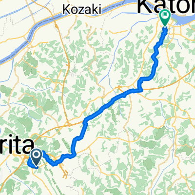
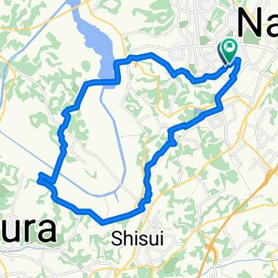
1600 Narita Airport
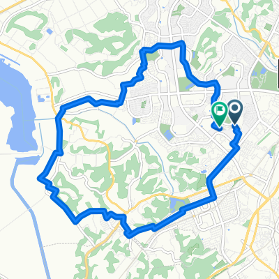
A cycling route starting in Narita, Chiba, Japan.
Overview
About this route
- -:--
- Duration
- 39.7 km
- Distance
- 142 m
- Ascent
- 142 m
- Descent
- ---
- Avg. speed
- ---
- Avg. speed
Route quality
Waytypes & surfaces along the route
Waytypes
Quiet road
19.7 km
(50 %)
Road
14 km
(35 %)
Surfaces
Paved
11.2 km
(28 %)
Unpaved
0.4 km
(<1 %)
Paved (undefined)
10.3 km
(26 %)
Asphalt
0.9 km
(2 %)
Route highlights
Points of interest along the route
Point of interest after 5.6 km
Narita Sakuranoyama Park
Point of interest after 8.8 km
Sanriduka Goryobokujo Kinenkan
Point of interest after 10.4 km
Sakurano Oka Park
Point of interest after 11.1 km
Hikokino Oka
Point of interest after 12.3 km
Soranoeki Fuwari Shibayama
Point of interest after 16 km
Shibayama Natural Fountain
Point of interest after 22.3 km
Sinbori Farm Entrance
Point of interest after 23.5 km
Green Water Park
Point of interest after 31.1 km
Toyomi Shinonomenono Oka
Continue with Bikemap
Use, edit, or download this cycling route
You would like to ride 1600 Narita Airport or customize it for your own trip? Here is what you can do with this Bikemap route:
Free features
- Save this route as favorite or in collections
- Copy & plan your own version of this route
- Sync your route with Garmin or Wahoo
Premium features
Free trial for 3 days, or one-time payment. More about Bikemap Premium.
- Navigate this route on iOS & Android
- Export a GPX / KML file of this route
- Create your custom printout (try it for free)
- Download this route for offline navigation
Discover more Premium features.
Get Bikemap PremiumFrom our community
Other popular routes starting in Narita
- Japon 1
- Distance
- 69.9 km
- Ascent
- 190 m
- Descent
- 155 m
- Location
- Narita, Chiba, Japan
- Narita-Tokyo CLONED FROM ROUTE 1547741
- Distance
- 89.8 km
- Ascent
- 187 m
- Descent
- 181 m
- Location
- Narita, Chiba, Japan
- Fleche 日光-那珂川-犬吠
- Distance
- 366.1 km
- Ascent
- 791 m
- Descent
- 810 m
- Location
- Narita, Chiba, Japan
- Narita-Countryside-Cycling
- Distance
- 66.9 km
- Ascent
- 235 m
- Descent
- 233 m
- Location
- Narita, Chiba, Japan
- Chiba-Satoyama-Cycling-BosoVillage-ShowaNoMori
- Distance
- 52 km
- Ascent
- 208 m
- Descent
- 160 m
- Location
- Narita, Chiba, Japan
- fleche backup route
- Distance
- 373.3 km
- Ascent
- 880 m
- Descent
- 885 m
- Location
- Narita, Chiba, Japan
- Narita to Ueno
- Distance
- 64.6 km
- Ascent
- 175 m
- Descent
- 185 m
- Location
- Narita, Chiba, Japan
- Route Day # 1A
- Distance
- 95.5 km
- Ascent
- 362 m
- Descent
- 338 m
- Location
- Narita, Chiba, Japan
Open it in the app