

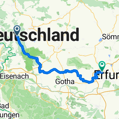
Tour Lengefeld Küllstedt Heyerode
A cycling route starting in Heyerode, Thuringia, Germany.
Overview
About this route
- 2 h 37 min
- Duration
- 40.7 km
- Distance
- 660 m
- Ascent
- 659 m
- Descent
- 15.5 km/h
- Avg. speed
- ---
- Max. altitude

Route quality
Waytypes & surfaces along the route
Waytypes
Path
15 km
(37 %)
Track
8.5 km
(21 %)
Surfaces
Paved
23.2 km
(57 %)
Unpaved
6.9 km
(17 %)
Asphalt
22.8 km
(56 %)
Gravel
4.9 km
(12 %)
Continue with Bikemap
Use, edit, or download this cycling route
You would like to ride Tour Lengefeld Küllstedt Heyerode or customize it for your own trip? Here is what you can do with this Bikemap route:
Free features
- Save this route as favorite or in collections
- Copy & plan your own version of this route
- Sync your route with Garmin or Wahoo
Premium features
Free trial for 3 days, or one-time payment. More about Bikemap Premium.
- Navigate this route on iOS & Android
- Export a GPX / KML file of this route
- Create your custom printout (try it for free)
- Download this route for offline navigation
Discover more Premium features.
Get Bikemap PremiumFrom our community
Other popular routes starting in Heyerode
 Werrarunde
- Distance
- 43.2 km
- Ascent
- 602 m
- Descent
- 599 m
- Location
- Heyerode, Thuringia, Germany
 Heyerode „Alter Bahnhof“ -Werra - Eisenach
- Distance
- 40.2 km
- Ascent
- 216 m
- Descent
- 404 m
- Location
- Heyerode, Thuringia, Germany
 Tour Lengefeld Küllstedt Heyerode
- Distance
- 40.7 km
- Ascent
- 660 m
- Descent
- 659 m
- Location
- Heyerode, Thuringia, Germany
 Hausstrecke Donnie
- Distance
- 23.1 km
- Ascent
- 433 m
- Descent
- 433 m
- Location
- Heyerode, Thuringia, Germany
 Am Wald 2, Südeichsfeld nach Marktplatz 6, Bad Sooden-Allendorf
- Distance
- 41.3 km
- Ascent
- 358 m
- Descent
- 572 m
- Location
- Heyerode, Thuringia, Germany
 Heyerode-Eschwege-Heyerode
- Distance
- 56.8 km
- Ascent
- 431 m
- Descent
- 457 m
- Location
- Heyerode, Thuringia, Germany
 nachEFvonHainich2025
- Distance
- 75.9 km
- Ascent
- 356 m
- Descent
- 580 m
- Location
- Heyerode, Thuringia, Germany
 Vogtei nach Bad Langensalza
- Distance
- 44.6 km
- Ascent
- 117 m
- Descent
- 344 m
- Location
- Heyerode, Thuringia, Germany
Open it in the app