

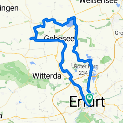
'Cappu19' Erfurt - BadSulza
A cycling route starting in Erfurt, Thuringia, Germany.
Overview
About this route
- -:--
- Duration
- 65.6 km
- Distance
- 147 m
- Ascent
- 299 m
- Descent
- ---
- Avg. speed
- ---
- Max. altitude

Route quality
Waytypes & surfaces along the route
Waytypes
Quiet road
21 km
(32 %)
Track
19 km
(29 %)
Surfaces
Paved
53.8 km
(82 %)
Unpaved
2.6 km
(4 %)
Asphalt
51.8 km
(79 %)
Concrete
2 km
(3 %)
Continue with Bikemap
Use, edit, or download this cycling route
You would like to ride 'Cappu19' Erfurt - BadSulza or customize it for your own trip? Here is what you can do with this Bikemap route:
Free features
- Save this route as favorite or in collections
- Copy & plan your own version of this route
- Sync your route with Garmin or Wahoo
Premium features
Free trial for 3 days, or one-time payment. More about Bikemap Premium.
- Navigate this route on iOS & Android
- Export a GPX / KML file of this route
- Create your custom printout (try it for free)
- Download this route for offline navigation
Discover more Premium features.
Get Bikemap PremiumFrom our community
Other popular routes starting in Erfurt
 L1055 nach L1055
- Distance
- 14.2 km
- Ascent
- 92 m
- Descent
- 144 m
- Location
- Erfurt, Thuringia, Germany
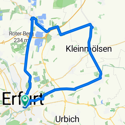
 Wachsenburgrunde - über Rehestädt
- Distance
- 54.3 km
- Ascent
- 256 m
- Descent
- 249 m
- Location
- Erfurt, Thuringia, Germany
 2016-10-23: TSK - LAU - ICE - TSK
- Distance
- 70.4 km
- Ascent
- 313 m
- Descent
- 314 m
- Location
- Erfurt, Thuringia, Germany
 Lutherstein
- Distance
- 20.3 km
- Ascent
- 143 m
- Descent
- 143 m
- Location
- Erfurt, Thuringia, Germany
 Erfurter Wesrrunde
- Distance
- 71.8 km
- Ascent
- 371 m
- Descent
- 374 m
- Location
- Erfurt, Thuringia, Germany
 Rund um die Erfurter Seen mit Restaurant Alberstädter See
- Distance
- 77.5 km
- Ascent
- 209 m
- Descent
- 211 m
- Location
- Erfurt, Thuringia, Germany
 Rings um den Flugplatz Bindersleben
- Distance
- 19.6 km
- Ascent
- 156 m
- Descent
- 156 m
- Location
- Erfurt, Thuringia, Germany
 Stotternheim
- Distance
- 33.7 km
- Ascent
- 145 m
- Descent
- 144 m
- Location
- Erfurt, Thuringia, Germany
Open it in the app