La Croix-Valmer (near St Tropez)
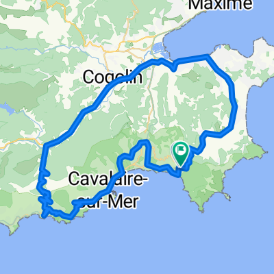
A cycling route starting in Ramatuelle, Provence-Alpes-C么te d'Azur Region, France.
Overview
About this route
Awesome summer ride that I do on holiday, nearly every day for 2 weeks.
Has everything, fantastic runs through the provence countryside with superb eye opening smells.
Nice profile ride as well, with plenty of ups and downs with a nice workout聽 climbing the "Col Du Vignon" at 352 m.
Short brush with the traffic entering/leaving St Tropez, but a buzz all the same overtaking the static Porche and Ferrari's. Passes through or near聽following villages;
-
Ramatuelle
-
Gassin
-
Porte Grimaud
-
Plan de la Tour
-
Garde-Freinet
-
Grimaud
-
Cogolin
-
La Croix-Valmer
-
Gigaro
聽
Doesn't get better than that !!
- -:--
- Duration
- 70.2 km
- Distance
- 834 m
- Ascent
- 841 m
- Descent
- ---
- Avg. speed
- ---
- Avg. speed
Route highlights
Points of interest along the route
Point of interest after 8.6 km
Point of interest after 10.7 km
Point of interest after 13 km
Point of interest after 13.6 km
Nice down speed up to 70 kph
Point of interest after 16.2 km
Point of interest after 19.3 km
Point of interest after 26.3 km
Point of interest after 31.3 km
Point of interest after 35.1 km
Point of interest after 37.6 km
Point of interest after 51.2 km
Point of interest after 67.5 km
Point of interest after 67.9 km
Point of interest after 69.4 km
Point of interest after 69.9 km
Continue with Bikemap
Use, edit, or download this cycling route
You would like to ride La Croix-Valmer (near St Tropez) or customize it for your own trip? Here is what you can do with this Bikemap route:
Free features
- Save this route as favorite or in collections
- Copy & plan your own version of this route
- Sync your route with Garmin or Wahoo
Premium features
Free trial for 3 days, or one-time payment. More about Bikemap Premium.
- Navigate this route on iOS & Android
- Export a GPX / KML file of this route
- Create your custom printout (try it for free)
- Download this route for offline navigation
Discover more Premium features.
Get Bikemap PremiumFrom our community
Other popular routes starting in Ramatuelle
- Saint Tropez
- Distance
- 52.5 km
- Ascent
- 616 m
- Descent
- 616 m
- Location
- Ramatuelle, Provence-Alpes-C么te d'Azur Region, France
- Ramatuelle1
- Distance
- 25.3 km
- Ascent
- 406 m
- Descent
- 407 m
- Location
- Ramatuelle, Provence-Alpes-C么te d'Azur Region, France
- Le Plan De La Tour, ST Tropez
- Distance
- 66.4 km
- Ascent
- 850 m
- Descent
- 959 m
- Location
- Ramatuelle, Provence-Alpes-C么te d'Azur Region, France
- Route2_flache_Gebirgsumfahrung_185km
- Distance
- 185.5 km
- Ascent
- 624 m
- Descent
- 639 m
- Location
- Ramatuelle, Provence-Alpes-C么te d'Azur Region, France
- Urlaubsrunde
- Distance
- 70.6 km
- Ascent
- 591 m
- Descent
- 600 m
- Location
- Ramatuelle, Provence-Alpes-C么te d'Azur Region, France
- Barcelona 13
- Distance
- 74.1 km
- Ascent
- 398 m
- Descent
- 402 m
- Location
- Ramatuelle, Provence-Alpes-C么te d'Azur Region, France
- Friedel_geplante_Route_1
- Distance
- 112.7 km
- Ascent
- 1,201 m
- Descent
- 1,201 m
- Location
- Ramatuelle, Provence-Alpes-C么te d'Azur Region, France
- Rundtour Ramatuelle
- Distance
- 47.6 km
- Ascent
- 789 m
- Descent
- 788 m
- Location
- Ramatuelle, Provence-Alpes-C么te d'Azur Region, France
Open it in the app