

SA Escarene Sospel Menton
A cycling route starting in Sainte-Agnès, Provence-Alpes-Côte d'Azur Region, France.
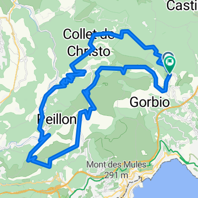
Overview
About this route
- -:--
- Duration
- 61.2 km
- Distance
- 1,202 m
- Ascent
- 1,864 m
- Descent
- ---
- Avg. speed
- ---
- Max. altitude

Route quality
Waytypes & surfaces along the route
Waytypes
Quiet road
22.6 km
(37 %)
Road
11 km
(18 %)
Surfaces
Paved
15.3 km
(25 %)
Unpaved
0.6 km
(1 %)
Asphalt
15.3 km
(25 %)
Gravel
0.6 km
(1 %)
Undefined
45.3 km
(74 %)
Continue with Bikemap
Use, edit, or download this cycling route
You would like to ride SA Escarene Sospel Menton or customize it for your own trip? Here is what you can do with this Bikemap route:
Free features
- Save this route as favorite or in collections
- Copy & plan your own version of this route
- Sync your route with Garmin or Wahoo
Premium features
Free trial for 3 days, or one-time payment. More about Bikemap Premium.
- Navigate this route on iOS & Android
- Export a GPX / KML file of this route
- Create your custom printout (try it for free)
- Download this route for offline navigation
Discover more Premium features.
Get Bikemap PremiumFrom our community
Other popular routes starting in Sainte-Agnès
 mentone
- Distance
- 85.9 km
- Ascent
- 1,448 m
- Descent
- 1,448 m
- Location
- Sainte-Agnès, Provence-Alpes-Côte d'Azur Region, France
 tour Castillon
- Distance
- 63.2 km
- Ascent
- 1,575 m
- Descent
- 1,575 m
- Location
- Sainte-Agnès, Provence-Alpes-Côte d'Azur Region, France
 De 4275 Route de l'Armée des Alpes, Sainte-Agnès à 279 Chemin du Chiauso, Sainte-Agnès
- Distance
- 50.9 km
- Ascent
- 920 m
- Descent
- 1,279 m
- Location
- Sainte-Agnès, Provence-Alpes-Côte d'Azur Region, France
 Route du Colonel-des Banquettes, Sainte-Agnès to Route du Colonel-des Banquettes, Sainte-Agnès
- Distance
- 40.1 km
- Ascent
- 2,722 m
- Descent
- 2,725 m
- Location
- Sainte-Agnès, Provence-Alpes-Côte d'Azur Region, France
 tur du bodon
- Distance
- 21.5 km
- Ascent
- 697 m
- Descent
- 710 m
- Location
- Sainte-Agnès, Provence-Alpes-Côte d'Azur Region, France
 Monte 2022 SD
- Distance
- 2.3 km
- Ascent
- 271 m
- Descent
- 131 m
- Location
- Sainte-Agnès, Provence-Alpes-Côte d'Azur Region, France
 sospel 1
- Distance
- 36.4 km
- Ascent
- 948 m
- Descent
- 945 m
- Location
- Sainte-Agnès, Provence-Alpes-Côte d'Azur Region, France
 Turini da Castillon
- Distance
- 94.1 km
- Ascent
- 3,310 m
- Descent
- 3,311 m
- Location
- Sainte-Agnès, Provence-Alpes-Côte d'Azur Region, France
Open it in the app