San Daniele-Rive Arcano traking
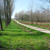
A cycling route starting in San Daniele del Friuli, Friuli Venezia Giulia, Italy.
Overview
About this route
- -:--
- Duration
- 16.4 km
- Distance
- 137 m
- Ascent
- 136 m
- Descent
- ---
- Avg. speed
- ---
- Avg. speed
Route quality
Waytypes & surfaces along the route
Waytypes
Track
10.1 km
(62 %)
Road
5 km
(30 %)
Surfaces
Paved
2.4 km
(14 %)
Unpaved
6.1 km
(37 %)
Gravel
3 km
(19 %)
Ground
2.4 km
(15 %)
Continue with Bikemap
Use, edit, or download this cycling route
You would like to ride San Daniele-Rive Arcano traking or customize it for your own trip? Here is what you can do with this Bikemap route:
Free features
- Save this route as favorite or in collections
- Copy & plan your own version of this route
- Sync your route with Garmin or Wahoo
Premium features
Free trial for 3 days, or one-time payment. More about Bikemap Premium.
- Navigate this route on iOS & Android
- Export a GPX / KML file of this route
- Create your custom printout (try it for free)
- Download this route for offline navigation
Discover more Premium features.
Get Bikemap PremiumFrom our community
Other popular routes starting in San Daniele del Friuli
- San Daniele-Rive Arcano traking
- Distance
- 16.4 km
- Ascent
- 137 m
- Descent
- 136 m
- Location
- San Daniele del Friuli, Friuli Venezia Giulia, Italy
- Clauzetto
- Distance
- 48.6 km
- Ascent
- 608 m
- Descent
- 616 m
- Location
- San Daniele del Friuli, Friuli Venezia Giulia, Italy
- S.DANIELE/F.M.REST/M.PRAT.
- Distance
- 134.4 km
- Ascent
- 2,421 m
- Descent
- 2,424 m
- Location
- San Daniele del Friuli, Friuli Venezia Giulia, Italy
- Von San Daniele nach Treviso
- Distance
- 287 km
- Ascent
- 2,558 m
- Descent
- 2,757 m
- Location
- San Daniele del Friuli, Friuli Venezia Giulia, Italy
- Wien-Venedig-2016-09
- Distance
- 95.8 km
- Ascent
- 30 m
- Descent
- 251 m
- Location
- San Daniele del Friuli, Friuli Venezia Giulia, Italy
- SanDanieleClauzettoTramontiRestPreoneArzino
- Distance
- 119.3 km
- Ascent
- 1,950 m
- Descent
- 1,950 m
- Location
- San Daniele del Friuli, Friuli Venezia Giulia, Italy
- Tra Lago e Castello di Ragogna
- Distance
- 34.8 km
- Ascent
- 322 m
- Descent
- 322 m
- Location
- San Daniele del Friuli, Friuli Venezia Giulia, Italy
- San Daniele-Buja-Ciro-49
- Distance
- 49.4 km
- Ascent
- 497 m
- Descent
- 497 m
- Location
- San Daniele del Friuli, Friuli Venezia Giulia, Italy
Open it in the app