

Vercors
A cycling route starting in Saint-Lattier, Auvergne-Rhône-Alpes, France.
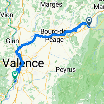
Overview
About this route
TOURNIOL 11 KM 7%
BACCHUS
COL DE LA CROIX 3 KM 8%
COL DE MARIGNAC 3 KM 7%
COL DU ROUSSET 14 KM 6%
Joli parcours qui nous fait traverser tous le plateau du Vercors. Une entame difficile avec le Col du Tourniol. Le col de bacchus facile. Le parcours est rythmé avec l'enchaînement du Col de la Croix et de Marignac. Et enfin, le beau morceau du Rousset. Avant le début du col, 5 km jusqu'à Chamaloc et enfin le col du Rousset débute. Une route large et roulante qui ne comporte pas de partie difficile. Arrivé en haut, il y a encore une multitude d'option. Du plus facile en continuant sur la route principale. Ou tourner en dir de Vassieux et le choix de Lachau ou Carri.
- -:--
- Duration
- 160.4 km
- Distance
- 2,589 m
- Ascent
- 2,568 m
- Descent
- ---
- Avg. speed
- ---
- Max. altitude

Route quality
Waytypes & surfaces along the route
Waytypes
Busy road
95.5 km
(60 %)
Road
39.8 km
(25 %)
Surfaces
Paved
87.2 km
(54 %)
Unpaved
1.9 km
(1 %)
Asphalt
87.1 km
(54 %)
Ground
1.4 km
(<1 %)
Route highlights
Points of interest along the route

Point of interest after 78.3 km

Point of interest after 105.6 km
Continue with Bikemap
Use, edit, or download this cycling route
You would like to ride Vercors or customize it for your own trip? Here is what you can do with this Bikemap route:
Free features
- Save this route as favorite or in collections
- Copy & plan your own version of this route
- Split it into stages to create a multi-day tour
- Sync your route with Garmin or Wahoo
Premium features
Free trial for 3 days, or one-time payment. More about Bikemap Premium.
- Navigate this route on iOS & Android
- Export a GPX / KML file of this route
- Create your custom printout (try it for free)
- Download this route for offline navigation
Discover more Premium features.
Get Bikemap PremiumFrom our community
Other popular routes starting in Saint-Lattier
 dessine moi un parcours
- Distance
- 111.3 km
- Ascent
- 792 m
- Descent
- 804 m
- Location
- Saint-Lattier, Auvergne-Rhône-Alpes, France
 Tour des collines, Eymeux
- Distance
- 7.1 km
- Ascent
- 191 m
- Descent
- 197 m
- Location
- Saint-Lattier, Auvergne-Rhône-Alpes, France
 mon petit challenge du dauphiné
- Distance
- 110.1 km
- Ascent
- 1,876 m
- Descent
- 1,845 m
- Location
- Saint-Lattier, Auvergne-Rhône-Alpes, France
 Saint-Lattier - Soyons
- Distance
- 60.2 km
- Ascent
- 219 m
- Descent
- 302 m
- Location
- Saint-Lattier, Auvergne-Rhône-Alpes, France
 Vercors
- Distance
- 160.4 km
- Ascent
- 2,589 m
- Descent
- 2,568 m
- Location
- Saint-Lattier, Auvergne-Rhône-Alpes, France
 07 St Lattier - Montelimar
- Distance
- 107.1 km
- Ascent
- 141 m
- Descent
- 227 m
- Location
- Saint-Lattier, Auvergne-Rhône-Alpes, France
 COLLINE ET ISERE
- Distance
- 79.4 km
- Ascent
- 707 m
- Descent
- 715 m
- Location
- Saint-Lattier, Auvergne-Rhône-Alpes, France
 De Le Village 1270, Saint-Lattier à Place de l'Église, Saint-Lattier
- Distance
- 34.9 km
- Ascent
- 1,455 m
- Descent
- 1,466 m
- Location
- Saint-Lattier, Auvergne-Rhône-Alpes, France
Open it in the app