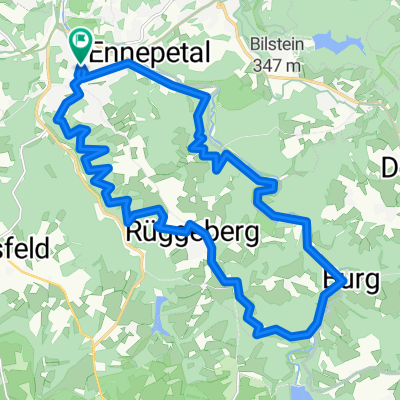
wieder mal Rund Rüggeberg
- 23.3 km
- 386 m
- 386 m
- Ennepetal, North Rhine-Westphalia, Germany
A cycling route starting in Ennepetal, North Rhine-Westphalia, Germany.
Overview
The starting point is, as usual, the parking lot at the Aldi store in Voerde. Then briefly along Feldstraße to the old railway track to Breckerfeld. From here it gets green. Follow this track with short interruptions until Brauck beneath the Breckerfeld mill. From here, a short section of bike path runs parallel to the road into the town center. I prefer to bypass the narrow town center from the roundabout via Westring to the Sparkasse, but that’s a matter of taste. After that, it continues uphill toward Wengeberg, where there is also a bike path marked in places. Upon reaching the top, it's then on the country road to Halver-Grünenbaum. Now turn right and continue toward Kamscheid via Vormbaum and Niedervahlefeld. Before Kamscheid, turn right and head toward the wind turbine. Continue through the forest, always descending, until you reach the Osenberg retention basin. There, cross the dam and then turn right. Shortly thereafter, it goes uphill again over stock and stone! Continue through the forest and pass Wellerhausen in the direction of Born. Please pay attention to the signs before the farm, as the bike path goes from the main path to the right across a narrow path: Do not go straight ahead, as the farm owner does not really like it and indicates it with a sign. After Böckel, follow the road along the Ennepetal dam. Then cross the dam and continue through the picturesque valley of the Ennepe. I prefer to go to Altenvoerde not via Loher Straße, but via the somewhat less truck-busy Milsper toward Voerde. Then through the village, and we are already back at the starting point.
created this 6 years ago


Route quality
Road
12 km
(32 %)
Path
9 km
(24 %)
Paved
23 km
(61 %)
Unpaved
8.3 km
(22 %)
Asphalt
23 km
(61 %)
Gravel
7.2 km
(19 %)
Route highlights

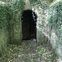
Am Niedernheede

Hier vom Hauptweg rechts abbiegen auf den schmalen Pfad
Continue with Bikemap
You would like to ride Mein Stammtrail mit viel Grün or customize it for your own trip? Here is what you can do with this Bikemap route:
Free trial for 3 days, or one-time payment. More about Bikemap Premium.
Discover more Premium features.
Get Bikemap PremiumFrom our community
Open it in the app