

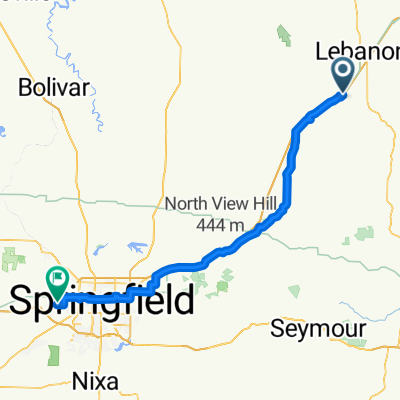
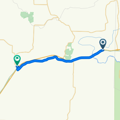
Lebanon Cycling
A cycling route starting in Lebanon, Missouri, United States.
Overview
About this route
- -:--
- Duration
- 99.7 km
- Distance
- 705 m
- Ascent
- 760 m
- Descent
- ---
- Avg. speed
- ---
- Max. altitude

Route quality
Waytypes & surfaces along the route
Waytypes
Busy road
59.5 km
(60 %)
Road
24.3 km
(24 %)
Surfaces
Paved
32 km
(32 %)
Unpaved
0.2 km
(<1 %)
Asphalt
20.2 km
(20 %)
Paved (undefined)
11.8 km
(12 %)
Continue with Bikemap
Use, edit, or download this cycling route
You would like to ride Lebanon Cycling or customize it for your own trip? Here is what you can do with this Bikemap route:
Free features
- Save this route as favorite or in collections
- Copy & plan your own version of this route
- Split it into stages to create a multi-day tour
- Sync your route with Garmin or Wahoo
Premium features
Free trial for 3 days, or one-time payment. More about Bikemap Premium.
- Navigate this route on iOS & Android
- Export a GPX / KML file of this route
- Create your custom printout (try it for free)
- Download this route for offline navigation
Discover more Premium features.
Get Bikemap PremiumFrom our community
Other popular routes starting in Lebanon
 Tour of Missouri
- Distance
- 157.2 km
- Ascent
- 690 m
- Descent
- 743 m
- Location
- Lebanon, Missouri, United States
 1221 Millcreek Rd, Lebanon to 1301 Banning St, Marshfield
- Distance
- 54.6 km
- Ascent
- 578 m
- Descent
- 512 m
- Location
- Lebanon, Missouri, United States
 20160924 ACA Route 66 Westbound Phillipsburg MO - Springfield MO #acaE6C2_2016
- Distance
- 94.8 km
- Ascent
- 308 m
- Descent
- 323 m
- Location
- Lebanon, Missouri, United States
 Route 66 (Missouri): Lebanon to Richland
- Distance
- 15.5 km
- Ascent
- 174 m
- Descent
- 137 m
- Location
- Lebanon, Missouri, United States
 Lebanon Cycling
- Distance
- 99.7 km
- Ascent
- 705 m
- Descent
- 760 m
- Location
- Lebanon, Missouri, United States
Open it in the app