

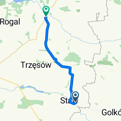
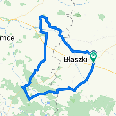
Błaszki (PKP) - Kalisz
A cycling route starting in Gmina Błaszki, Łódź Voivodeship, Poland.
Overview
About this route
- -:--
- Duration
- 54.7 km
- Distance
- 103 m
- Ascent
- 121 m
- Descent
- ---
- Avg. speed
- ---
- Max. altitude
Route highlights
Points of interest along the route
 - Kalisz\"")
Photo after 0.8 km
 - Kalisz\"")
Photo after 4.3 km
 - Kalisz\"")
Photo after 11.8 km
Dwor
 - Kalisz\"")
Photo after 13.4 km
Kosciol
Point of interest after 22 km
…w 2003 r. wybuchła poważna afera. Oprócz kościoła, katolicy wykupili od ewangelików cmentarz. Zaradny proboszcz postanowił zdjąć płyty z opuszczonych (w zasadzie prawie wszystkich) grobów, umieścić je w rzędzie pod płotem, a z podmurówek urządzić chodnik przykościelny.
 - Kalisz\"")
Photo after 22.1 km
Kosciol
 - Kalisz\"")
Photo after 28.5 km
Continue with Bikemap
Use, edit, or download this cycling route
You would like to ride Błaszki (PKP) - Kalisz or customize it for your own trip? Here is what you can do with this Bikemap route:
Free features
- Save this route as favorite or in collections
- Copy & plan your own version of this route
- Sync your route with Garmin or Wahoo
Premium features
Free trial for 3 days, or one-time payment. More about Bikemap Premium.
- Navigate this route on iOS & Android
- Export a GPX / KML file of this route
- Create your custom printout (try it for free)
- Download this route for offline navigation
Discover more Premium features.
Get Bikemap PremiumFrom our community
Other popular routes starting in Gmina Błaszki
 Lipka, Szczytniki do pl Wolności, Koźminek
- Distance
- 13.2 km
- Ascent
- 28 m
- Descent
- 28 m
- Location
- Gmina Błaszki, Łódź Voivodeship, Poland
 11B do Zawady
- Distance
- 70.2 km
- Ascent
- 269 m
- Descent
- 267 m
- Location
- Gmina Błaszki, Łódź Voivodeship, Poland
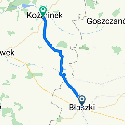 pl Sulwińskiego, Błaszki do Nakwasińska, Koźminek
- Distance
- 21 km
- Ascent
- 24 m
- Descent
- 45 m
- Location
- Gmina Błaszki, Łódź Voivodeship, Poland
 Błaszki (PKP) - Kalisz
- Distance
- 54.7 km
- Ascent
- 103 m
- Descent
- 121 m
- Location
- Gmina Błaszki, Łódź Voivodeship, Poland
 Smaszków do 3A, Smaszków
- Distance
- 37.6 km
- Ascent
- 188 m
- Descent
- 184 m
- Location
- Gmina Błaszki, Łódź Voivodeship, Poland
 Szczytniki 57, Szczytniki do Szczytniki 77, Szczytniki
- Distance
- 4.3 km
- Ascent
- 47 m
- Descent
- 27 m
- Location
- Gmina Błaszki, Łódź Voivodeship, Poland
 03.06.2011
- Distance
- 38.5 km
- Ascent
- 92 m
- Descent
- 91 m
- Location
- Gmina Błaszki, Łódź Voivodeship, Poland
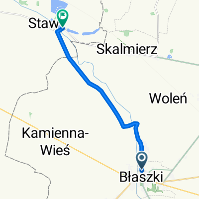 Kościelna, Błaszki do Lipka, Szczytniki
- Distance
- 7.8 km
- Ascent
- 3 m
- Descent
- 21 m
- Location
- Gmina Błaszki, Łódź Voivodeship, Poland
Open it in the app