

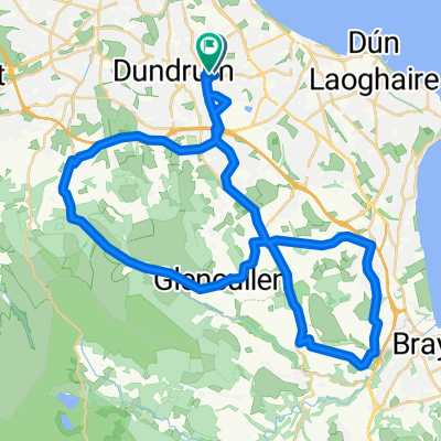
Goatstown to Killiney Head
A cycling route starting in Mount Merrion, Leinster, Ireland.
Overview
About this route
- 46 min
- Duration
- 11.3 km
- Distance
- 151 m
- Ascent
- 98 m
- Descent
- 14.8 km/h
- Avg. speed
- ---
- Max. altitude

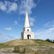
Route photos


Continue with Bikemap
Use, edit, or download this cycling route
You would like to ride Goatstown to Killiney Head or customize it for your own trip? Here is what you can do with this Bikemap route:
Free features
- Save this route as favorite or in collections
- Copy & plan your own version of this route
- Sync your route with Garmin or Wahoo
Premium features
Free trial for 3 days, or one-time payment. More about Bikemap Premium.
- Navigate this route on iOS & Android
- Export a GPX / KML file of this route
- Create your custom printout (try it for free)
- Download this route for offline navigation
Discover more Premium features.
Get Bikemap PremiumFrom our community
Other popular routes starting in Mount Merrion
 North & South Coast Route
- Distance
- 119.6 km
- Ascent
- 763 m
- Descent
- 763 m
- Location
- Mount Merrion, Leinster, Ireland
 Coastal Route
- Distance
- 71 km
- Ascent
- 763 m
- Descent
- 760 m
- Location
- Mount Merrion, Leinster, Ireland
 Pine Forrest Road
- Distance
- 43.3 km
- Ascent
- 514 m
- Descent
- 512 m
- Location
- Mount Merrion, Leinster, Ireland
 Dublin
- Distance
- 49.9 km
- Ascent
- 150 m
- Descent
- 160 m
- Location
- Mount Merrion, Leinster, Ireland
 Goatstown to Killiney Head
- Distance
- 11.3 km
- Ascent
- 151 m
- Descent
- 98 m
- Location
- Mount Merrion, Leinster, Ireland
 Short Country Road Route
- Distance
- 34.8 km
- Ascent
- 446 m
- Descent
- 444 m
- Location
- Mount Merrion, Leinster, Ireland
 36 Roebuck Road, Clonskeagh to 4–12 Roebuck Road, Clonskeagh
- Distance
- 0.3 km
- Ascent
- 0 m
- Descent
- 0 m
- Location
- Mount Merrion, Leinster, Ireland
 Tandem The Twin Towers
- Distance
- 18.7 km
- Ascent
- 279 m
- Descent
- 280 m
- Location
- Mount Merrion, Leinster, Ireland
Open it in the app