

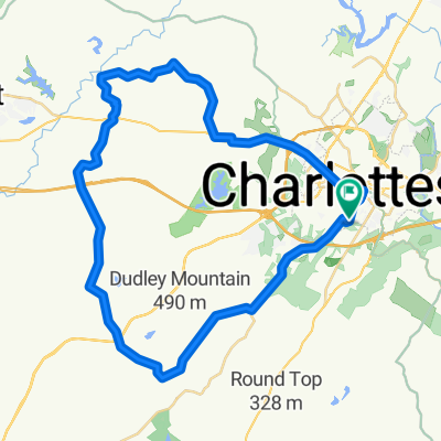
Red Hill Lollypop
A cycling route starting in Charlottesville, Virginia, United States.
Overview
About this route
- -:--
- Duration
- 24.3 km
- Distance
- 280 m
- Ascent
- 289 m
- Descent
- ---
- Avg. speed
- ---
- Max. altitude

Route quality
Waytypes & surfaces along the route
Waytypes
Quiet road
8 km
(33 %)
Road
4.6 km
(19 %)
Surfaces
Paved
21.6 km
(89 %)
Unpaved
1 km
(4 %)
Asphalt
21.6 km
(89 %)
Unpaved (undefined)
1 km
(4 %)
Undefined
1.7 km
(7 %)
Continue with Bikemap
Use, edit, or download this cycling route
You would like to ride Red Hill Lollypop or customize it for your own trip? Here is what you can do with this Bikemap route:
Free features
- Save this route as favorite or in collections
- Copy & plan your own version of this route
- Sync your route with Garmin or Wahoo
Premium features
Free trial for 3 days, or one-time payment. More about Bikemap Premium.
- Navigate this route on iOS & Android
- Export a GPX / KML file of this route
- Create your custom printout (try it for free)
- Download this route for offline navigation
Discover more Premium features.
Get Bikemap PremiumFrom our community
Other popular routes starting in Charlottesville
 Dry Bridge-Tillman loop
- Distance
- 49.5 km
- Ascent
- 440 m
- Descent
- 440 m
- Location
- Charlottesville, Virginia, United States
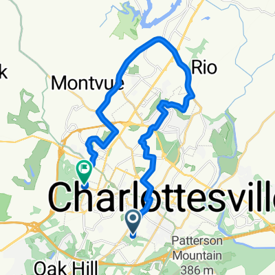 LongWay
- Distance
- 20 km
- Ascent
- 211 m
- Descent
- 165 m
- Location
- Charlottesville, Virginia, United States
 Slow ride in Charlottesville
- Distance
- 20.1 km
- Ascent
- 462 m
- Descent
- 471 m
- Location
- Charlottesville, Virginia, United States
 DAY 20 Charlottesville - Ashland
- Distance
- 158 km
- Ascent
- 390 m
- Descent
- 480 m
- Location
- Charlottesville, Virginia, United States
 Saint Charles Avenue 850, Charlottesville to Saint Charles Avenue 850, Charlottesville
- Distance
- 14.8 km
- Ascent
- 145 m
- Descent
- 148 m
- Location
- Charlottesville, Virginia, United States
 Keswick to Lake Monticello Loop
- Distance
- 41.4 km
- Ascent
- 255 m
- Descent
- 258 m
- Location
- Charlottesville, Virginia, United States
 Wine St. to Sachem Village
- Distance
- 6.5 km
- Ascent
- 112 m
- Descent
- 87 m
- Location
- Charlottesville, Virginia, United States
 Charlottesville Loop
- Distance
- 29 km
- Ascent
- 359 m
- Descent
- 361 m
- Location
- Charlottesville, Virginia, United States
Open it in the app