

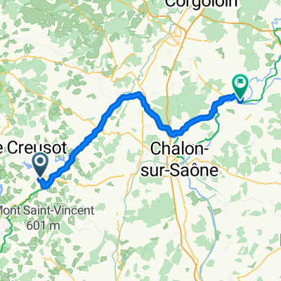
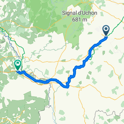
VL - Montchanin - Paray - Decize - Cercy
A cycling route starting in Montchanin, Bourgogne-Franche-Comté, France.
Overview
About this route
Canal du Centre, lateral canal to the Loire
- -:--
- Duration
- 185.1 km
- Distance
- 221 m
- Ascent
- 247 m
- Descent
- ---
- Avg. speed
- 325 m
- Max. altitude
Route quality
Waytypes & surfaces along the route
Waytypes
Road
51.8 km
(28 %)
Path
38.9 km
(21 %)
Surfaces
Paved
79.6 km
(43 %)
Unpaved
1.9 km
(1 %)
Asphalt
72.2 km
(39 %)
Paved (undefined)
7.4 km
(4 %)
Continue with Bikemap
Use, edit, or download this cycling route
You would like to ride VL - Montchanin - Paray - Decize - Cercy or customize it for your own trip? Here is what you can do with this Bikemap route:
Free features
- Save this route as favorite or in collections
- Copy & plan your own version of this route
- Split it into stages to create a multi-day tour
- Sync your route with Garmin or Wahoo
Premium features
Free trial for 3 days, or one-time payment. More about Bikemap Premium.
- Navigate this route on iOS & Android
- Export a GPX / KML file of this route
- Create your custom printout (try it for free)
- Download this route for offline navigation
Discover more Premium features.
Get Bikemap PremiumFrom our community
Other popular routes starting in Montchanin
 VL - Montchanin - Paray - Decize - Cercy
- Distance
- 185.1 km
- Ascent
- 221 m
- Descent
- 247 m
- Location
- Montchanin, Bourgogne-Franche-Comté, France
 Morvan reverse edition
- Distance
- 244.3 km
- Ascent
- 1,851 m
- Descent
- 1,930 m
- Location
- Montchanin, Bourgogne-Franche-Comté, France
 Etape 1 Ride Brigade 2013
- Distance
- 175.7 km
- Ascent
- 1,585 m
- Descent
- 1,625 m
- Location
- Montchanin, Bourgogne-Franche-Comté, France
 Notfall 2
- Distance
- 1,105.7 km
- Ascent
- 6,820 m
- Descent
- 6,963 m
- Location
- Montchanin, Bourgogne-Franche-Comté, France
 Montchanin-Chalons sur Saone
- Distance
- 62 km
- Ascent
- 250 m
- Descent
- 397 m
- Location
- Montchanin, Bourgogne-Franche-Comté, France
 From Montchanin to Verdun-sur-le-Doubs
- Distance
- 67.6 km
- Ascent
- 115 m
- Descent
- 269 m
- Location
- Montchanin, Bourgogne-Franche-Comté, France
 1 ère étape Summer ride (variante Genouilly)
- Distance
- 151.8 km
- Ascent
- 1,416 m
- Descent
- 1,454 m
- Location
- Montchanin, Bourgogne-Franche-Comté, France
 Montchanin - Dompierre-sur-Besbre
- Distance
- 98.7 km
- Ascent
- 426 m
- Descent
- 523 m
- Location
- Montchanin, Bourgogne-Franche-Comté, France
Open it in the app