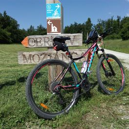
Pot čez Visoke
A cycling route starting in Slovenski Javornik, Jesenice, Slovenia.
Overview
About this route
We start the route from the parking lot in front of the Slovenian Alpine Museum. Continue towards Dovje. We reach the Požgančeva bridge, under which the Sava Dolinka river flows. After the bridge, continue straight ahead (to the left the road goes towards Kranjska Gora), where a steep climb begins up to the main road.
Cross the main road and continue climbing towards the village of Dovje. At the junction (a chapel on the left, old school on the right), turn right – 1.5 km. Ride across the main square and continue towards the new part of Dovje. At the next junction, turn left towards Dovška Baba – 1.8 km. At the end of Dovje village, the asphalt road turns into gravel, which you follow to the next junction and keep to the right – 2.4 km, 760 m. There is a short gentle descent to Mlinca power station, then the climb starts again. The road steadily ascends. On the next ascent to the following junction (approx. 4 km), there are many pastures on both sides where livestock graze in the season. The road leads under the mighty Blašič rock, reminiscent of the famous Tre Cime in the Dolomites. At the end of the first climb (about 1 km before the junction), the road levels off. At the next junction (for Dovška Baba-Ravne) turn right towards Visoke – 6.7 km, 1080 m. Another 1.9 km of ascent leads up to the saddle at Visoke – 8.6 km, 1200 m.
Now a descent follows towards Plavški Rovt. At Zakamnik pasture, turn right towards Plavški Rovt – 11.5 km, 1025 m. Descend to the village of Plavški Rovt, where the asphalt road resumes. At the end of the village, there is a very short climb. Then another descent to Jesenice follows.
At the junction by the health center (on your right), turn left – 16.6 km, 570 m. Ride 500 m on the main road, then at the junction before the Petrol gas station, turn left. Descend 40 m, then turn left once again. Another short climb follows, descend straight (the company Doka is on the right) to the next junction, where you turn left – 17.6 km. Cross the bridge over the Sava Dolinka and go straight under the motorway underpass to the junction with the cycling path. Here, turn right and join the cycling path that leads towards Mojstrana. The cycling path runs on the left side of the Karavanke plateau, through Mlake, and joins the main road at Savski bridge, which leads into Mojstrana – 24.4 km. Follow the road past the ski resort. Arrive in Mojstrana village, cross the bridge (info point on the right) under which flows the Triglavska Bistrica river. At the junction, turn left towards Vrata and after 500 m you will reach your starting point – 26.5 km.
- -:--
- Duration
- 36.7 km
- Distance
- 789 m
- Ascent
- 789 m
- Descent
- ---
- Avg. speed
- ---
- Max. altitude
Route quality
Waytypes & surfaces along the route
Waytypes
Quiet road
16.2 km
(44 %)
Access road
8.4 km
(23 %)
Surfaces
Paved
18.4 km
(50 %)
Unpaved
11 km
(30 %)
Asphalt
18.4 km
(50 %)
Gravel
10.6 km
(29 %)
Continue with Bikemap
Use, edit, or download this cycling route
You would like to ride Pot čez Visoke or customize it for your own trip? Here is what you can do with this Bikemap route:
Free features
- Save this route as favorite or in collections
- Copy & plan your own version of this route
- Sync your route with Garmin or Wahoo
Premium features
Free trial for 3 days, or one-time payment. More about Bikemap Premium.
- Navigate this route on iOS & Android
- Export a GPX / KML file of this route
- Create your custom printout (try it for free)
- Download this route for offline navigation
Discover more Premium features.
Get Bikemap PremiumFrom our community
Other popular routes starting in Slovenski Javornik
 Ljubelj, Koren krog
- Distance
- 136.7 km
- Ascent
- 1,616 m
- Descent
- 1,677 m
- Location
- Slovenski Javornik, Jesenice, Slovenia
 Biking Radovna and Upper Sava valley
- Distance
- 38.7 km
- Ascent
- 829 m
- Descent
- 831 m
- Location
- Slovenski Javornik, Jesenice, Slovenia
 Zavelcinov Rovt
- Distance
- 15.4 km
- Ascent
- 672 m
- Descent
- 672 m
- Location
- Slovenski Javornik, Jesenice, Slovenia
 Bl.Dobrava-Mrzli Studenec-Goreljek-Podjele-Pic.Ema-Danica-Žel.postaja
- Distance
- 44 km
- Ascent
- 856 m
- Descent
- 920 m
- Location
- Slovenski Javornik, Jesenice, Slovenia
 Dom Pristava
- Distance
- 5.5 km
- Ascent
- 457 m
- Descent
- 65 m
- Location
- Slovenski Javornik, Jesenice, Slovenia
 Slovenski Javornik - Ljubljana čez Vodice
- Distance
- 67.5 km
- Ascent
- 206 m
- Descent
- 437 m
- Location
- Slovenski Javornik, Jesenice, Slovenia
 Pot čez Visoke
- Distance
- 36.7 km
- Ascent
- 789 m
- Descent
- 789 m
- Location
- Slovenski Javornik, Jesenice, Slovenia
 Jesenice - Draga - pod gorami - Tržič - Podbrezje - Posavec - Lesce
- Distance
- 60.9 km
- Ascent
- 440 m
- Descent
- 440 m
- Location
- Slovenski Javornik, Jesenice, Slovenia
Open it in the app


