

ev4 pougasnou-trebeuden
A cycling route starting in Plougasnou, Brittany Region, France.
Overview
About this route
- 8 h 33 min
- Duration
- 58.1 km
- Distance
- 1,152 m
- Ascent
- 1,123 m
- Descent
- 6.8 km/h
- Avg. speed
- ---
- Max. altitude
Route quality
Waytypes & surfaces along the route
Waytypes
Quiet road
20.9 km
(36 %)
Road
18.6 km
(32 %)
Surfaces
Paved
33.7 km
(58 %)
Unpaved
4.1 km
(7 %)
Asphalt
33.7 km
(58 %)
Gravel
2.9 km
(5 %)
Continue with Bikemap
Use, edit, or download this cycling route
You would like to ride ev4 pougasnou-trebeuden or customize it for your own trip? Here is what you can do with this Bikemap route:
Free features
- Save this route as favorite or in collections
- Copy & plan your own version of this route
- Sync your route with Garmin or Wahoo
Premium features
Free trial for 3 days, or one-time payment. More about Bikemap Premium.
- Navigate this route on iOS & Android
- Export a GPX / KML file of this route
- Create your custom printout (try it for free)
- Download this route for offline navigation
Discover more Premium features.
Get Bikemap PremiumFrom our community
Other popular routes starting in Plougasnou
 De Route de la Plage, Plougasnou à Rue des Sables Blancs 15, Locquirec
- Distance
- 12.5 km
- Ascent
- 189 m
- Descent
- 174 m
- Location
- Plougasnou, Brittany Region, France
 De Kerdreïn 114, Saint-Jean-du-Doigt à Kervourc’H 246, Guimaëc
- Distance
- 2.7 km
- Ascent
- 22 m
- Descent
- 3 m
- Location
- Plougasnou, Brittany Region, France
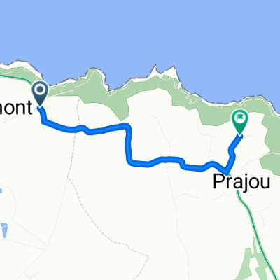
 ev4 pougasnou-trebeuden
- Distance
- 58.1 km
- Ascent
- 1,152 m
- Descent
- 1,123 m
- Location
- Plougasnou, Brittany Region, France
 De Rue de Pors Louarn 14, Plougasnou à Chemin de Lezouzard 28, Plougasnou
- Distance
- 5.7 km
- Ascent
- 98 m
- Descent
- 32 m
- Location
- Plougasnou, Brittany Region, France
 St Jean - Derval
- Distance
- 259.5 km
- Ascent
- 660 m
- Descent
- 668 m
- Location
- Plougasnou, Brittany Region, France
 De Kervourc’H 246, Guimaëc à Rue Pors ar Villiec 13B, Locquirec
- Distance
- 10.5 km
- Ascent
- 102 m
- Descent
- 167 m
- Location
- Plougasnou, Brittany Region, France
 De Chemin de Lezouzard 28, Plougasnou à Kerdreïn 115, Saint-Jean-du-Doigt
- Distance
- 4.2 km
- Ascent
- 71 m
- Descent
- 83 m
- Location
- Plougasnou, Brittany Region, France
 Plougasnou- Saint Quay Portrieux 0506
- Distance
- 199.7 km
- Ascent
- 798 m
- Descent
- 783 m
- Location
- Plougasnou, Brittany Region, France
Open it in the app