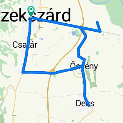
0. nap
A cycling route starting in SzekszĂĄrd, Tolna County, Hungary.
Overview
About this route
- -:--
- Duration
- 13.1 km
- Distance
- 158 m
- Ascent
- 105 m
- Descent
- ---
- Avg. speed
- ---
- Max. altitude
Route quality
Waytypes & surfaces along the route
Waytypes
Quiet road
5.6 km
(43 %)
Busy road
3.3 km
(25 %)
Surfaces
Paved
10.8 km
(82 %)
Unpaved
1.1 km
(8 %)
Asphalt
8.2 km
(62 %)
Concrete
2.6 km
(20 %)
Route highlights
Points of interest along the route
Point of interest after 6 km
Na, ez az Ăștszakasz nem volt. Csak dzsungel helyette.
Continue with Bikemap
Use, edit, or download this cycling route
You would like to ride 0. nap or customize it for your own trip? Here is what you can do with this Bikemap route:
Free features
- Save this route as favorite or in collections
- Copy & plan your own version of this route
- Sync your route with Garmin or Wahoo
Premium features
Free trial for 3 days, or one-time payment. More about Bikemap Premium.
- Navigate this route on iOS & Android
- Export a GPX / KML file of this route
- Create your custom printout (try it for free)
- Download this route for offline navigation
Discover more Premium features.
Get Bikemap PremiumFrom our community
Other popular routes starting in SzekszĂĄrd
- A kĂ©t hĂd turĂĄja
- Distance
- 74.4 km
- Ascent
- 74 m
- Descent
- 73 m
- Location
- SzekszĂĄrd, Tolna County, Hungary
- Bartina 15
- Distance
- 15.7 km
- Ascent
- 451 m
- Descent
- 429 m
- Location
- SzekszĂĄrd, Tolna County, Hungary
- 0. nap
- Distance
- 13.1 km
- Ascent
- 158 m
- Descent
- 105 m
- Location
- SzekszĂĄrd, Tolna County, Hungary
- From SzekszĂĄrd to Baja
- Distance
- 41.3 km
- Ascent
- 85 m
- Descent
- 91 m
- Location
- SzekszĂĄrd, Tolna County, Hungary
- SzekszĂĄrd-SĂĄrpilis-SzĂĄlka-SzekszĂĄrd
- Distance
- 49.9 km
- Ascent
- 216 m
- Descent
- 216 m
- Location
- SzekszĂĄrd, Tolna County, Hungary
- "8"-as tĂșra
- Distance
- 34.9 km
- Ascent
- 368 m
- Descent
- 368 m
- Location
- SzekszĂĄrd, Tolna County, Hungary
- SzekszĂĄrd-SĂŒkösd-NemesnĂĄdudvar
- Distance
- 48.5 km
- Ascent
- 102 m
- Descent
- 107 m
- Location
- SzekszĂĄrd, Tolna County, Hungary
- SzekszĂĄrd-SzĂĄlka erdĆn ĂĄt
- Distance
- 12.8 km
- Ascent
- 225 m
- Descent
- 128 m
- Location
- SzekszĂĄrd, Tolna County, Hungary
Open it in the app