

4. nap
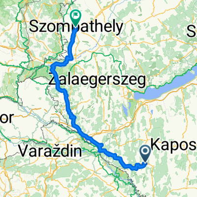
A cycling route starting in Nagyatád, Somogy County, Hungary.
Overview
About this route
- -:--
- Duration
- 63.8 km
- Distance
- 0 m
- Ascent
- 126 m
- Descent
- ---
- Avg. speed
- ---
- Max. altitude

Route quality
Waytypes & surfaces along the route
Waytypes
Quiet road
22.3 km
(35 %)
Cycleway
4.5 km
(7 %)
Surfaces
Paved
23.6 km
(37 %)
Asphalt
23 km
(36 %)
Paved (undefined)
0.6 km
(1 %)
Undefined
40.2 km
(63 %)
Route highlights
Points of interest along the route
Point of interest after 17.5 km
Szép hely
Point of interest after 47.3 km
Sand, kocsma
Point of interest after 59.5 km
Halászcsárda, Kulik Juli
Point of interest after 63.8 km
Zalakaros, nagyon rossz kemping
Continue with Bikemap
Use, edit, or download this cycling route
You would like to ride 4. nap or customize it for your own trip? Here is what you can do with this Bikemap route:
Free features
- Save this route as favorite or in collections
- Copy & plan your own version of this route
- Sync your route with Garmin or Wahoo
Premium features
Free trial for 3 days, or one-time payment. More about Bikemap Premium.
- Navigate this route on iOS & Android
- Export a GPX / KML file of this route
- Create your custom printout (try it for free)
- Download this route for offline navigation
Discover more Premium features.
Get Bikemap PremiumFrom our community
Other popular routes starting in Nagyatád
 Csalogány sor 32., Nagyatád to Csalogány sor 32., Nagyatád
- Distance
- 31.7 km
- Ascent
- 117 m
- Descent
- 115 m
- Location
- Nagyatád, Somogy County, Hungary
 From Nagyatád to Mohács
- Distance
- 151.8 km
- Ascent
- 1,831 m
- Descent
- 1,876 m
- Location
- Nagyatád, Somogy County, Hungary
 Nagyatádi eXtremeMan bringa FÉLTÁV 2016
- Distance
- 95.5 km
- Ascent
- 172 m
- Descent
- 183 m
- Location
- Nagyatád, Somogy County, Hungary
 Nagyatád-Drávatamási
- Distance
- 60.6 km
- Ascent
- 55 m
- Descent
- 76 m
- Location
- Nagyatád, Somogy County, Hungary
 4. nap
- Distance
- 63.8 km
- Ascent
- 0 m
- Descent
- 126 m
- Location
- Nagyatád, Somogy County, Hungary
 Szent Flórián tér - Nagykar utca
- Distance
- 224.4 km
- Ascent
- 1,093 m
- Descent
- 1,006 m
- Location
- Nagyatád, Somogy County, Hungary
 4. nap terv
- Distance
- 60.3 km
- Ascent
- 290 m
- Descent
- 280 m
- Location
- Nagyatád, Somogy County, Hungary
 Geocaching Nagyatád
- Distance
- 67.4 km
- Ascent
- 129 m
- Descent
- 114 m
- Location
- Nagyatád, Somogy County, Hungary
Open it in the app