

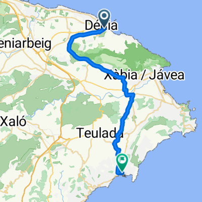
Cullera-Denia
A cycling route starting in Denia, Valencia, Spain.
Overview
About this route
- -:--
- Duration
- 59.2 km
- Distance
- 64 m
- Ascent
- 61 m
- Descent
- ---
- Avg. speed
- ---
- Avg. speed

Route quality
Waytypes & surfaces along the route
Waytypes
Quiet road
27.1 km
(46 %)
Cycleway
14.4 km
(24 %)
Surfaces
Paved
28.8 km
(49 %)
Asphalt
26.3 km
(44 %)
Paved (undefined)
1.9 km
(3 %)
Continue with Bikemap
Use, edit, or download this cycling route
You would like to ride Cullera-Denia or customize it for your own trip? Here is what you can do with this Bikemap route:
Free features
- Save this route as favorite or in collections
- Copy & plan your own version of this route
- Sync your route with Garmin or Wahoo
Premium features
Free trial for 3 days, or one-time payment. More about Bikemap Premium.
- Navigate this route on iOS & Android
- Export a GPX / KML file of this route
- Create your custom printout (try it for free)
- Download this route for offline navigation
Discover more Premium features.
Get Bikemap PremiumFrom our community
Other popular routes starting in Denia
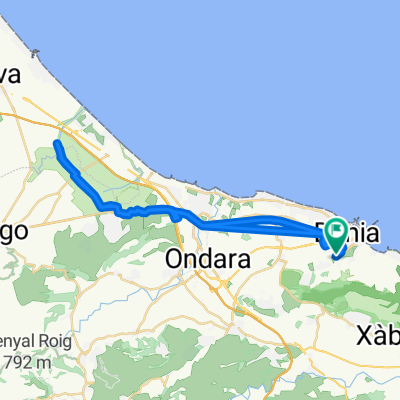
 Dénia - Moraira
- Distance
- 27.6 km
- Ascent
- 354 m
- Descent
- 355 m
- Location
- Denia, Valencia, Spain
 Ruta TCAF- Josemi
- Distance
- 25.9 km
- Ascent
- 400 m
- Descent
- 400 m
- Location
- Denia, Valencia, Spain
 Senderisme Montgó
- Distance
- 14.8 km
- Ascent
- 792 m
- Descent
- 792 m
- Location
- Denia, Valencia, Spain
 riu Gorgos
- Distance
- 28.4 km
- Ascent
- 252 m
- Descent
- 253 m
- Location
- Denia, Valencia, Spain
 SAC Vuelta Via Verdes Rondrit vanuit Denia
- Distance
- 39.5 km
- Ascent
- 423 m
- Descent
- 423 m
- Location
- Denia, Valencia, Spain
 Denia Day 1 Pego
- Distance
- 74.5 km
- Ascent
- 376 m
- Descent
- 375 m
- Location
- Denia, Valencia, Spain
 2016-08agosto-13 - FAMORCA
- Distance
- 108.2 km
- Ascent
- 1,033 m
- Descent
- 1,032 m
- Location
- Denia, Valencia, Spain
 Ruta hacia la Font Salada.
- Distance
- 42.6 km
- Ascent
- 64 m
- Descent
- 64 m
- Location
- Denia, Valencia, Spain
Open it in the app