

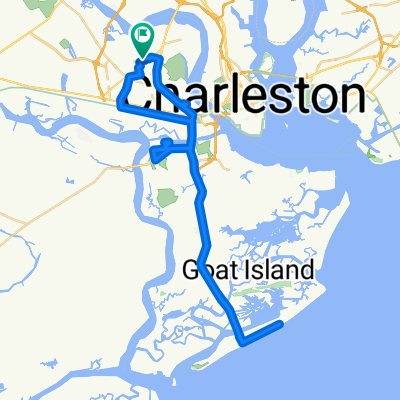
Charleston Bridge 17
A cycling route starting in North Charleston, South Carolina, United States.
Overview
About this route
- -:--
- Duration
- 32.3 km
- Distance
- 60 m
- Ascent
- 54 m
- Descent
- ---
- Avg. speed
- ---
- Max. altitude

Route quality
Waytypes & surfaces along the route
Waytypes
Road
14.6 km
(45 %)
Busy road
7.4 km
(23 %)
Surfaces
Paved
7.4 km
(23 %)
Asphalt
7.3 km
(23 %)
Concrete
0 km
(<1 %)
Undefined
24.9 km
(77 %)
Continue with Bikemap
Use, edit, or download this cycling route
You would like to ride Charleston Bridge 17 or customize it for your own trip? Here is what you can do with this Bikemap route:
Free features
- Save this route as favorite or in collections
- Copy & plan your own version of this route
- Sync your route with Garmin or Wahoo
Premium features
Free trial for 3 days, or one-time payment. More about Bikemap Premium.
- Navigate this route on iOS & Android
- Export a GPX / KML file of this route
- Create your custom printout (try it for free)
- Download this route for offline navigation
Discover more Premium features.
Get Bikemap PremiumFrom our community
Other popular routes starting in North Charleston
 Old Towne Plantation Rd, Charleston to 1500 Old Towne Rd, Charleston
- Distance
- 3.6 km
- Ascent
- 25 m
- Descent
- 24 m
- Location
- North Charleston, South Carolina, United States
 Charleston Bridge 17
- Distance
- 32.3 km
- Ascent
- 60 m
- Descent
- 54 m
- Location
- North Charleston, South Carolina, United States
 1510 Birthright St, Charleston to 1509 Birthright St, Charleston
- Distance
- 63.6 km
- Ascent
- 270 m
- Descent
- 282 m
- Location
- North Charleston, South Carolina, United States
 Work
Work- Distance
- 10.9 km
- Ascent
- 83 m
- Descent
- 83 m
- Location
- North Charleston, South Carolina, United States
 Restful route in Charleston
- Distance
- 27.3 km
- Ascent
- 4 m
- Descent
- 4 m
- Location
- North Charleston, South Carolina, United States
 USA Trip - Tag 17
- Distance
- 694.5 km
- Ascent
- 120 m
- Descent
- 118 m
- Location
- North Charleston, South Carolina, United States
 2415 Mall Dr, North Charleston to 1801 Reynolds Ave, North Charleston
- Distance
- 7.4 km
- Ascent
- 34 m
- Descent
- 35 m
- Location
- North Charleston, South Carolina, United States
 2403 Mall Dr, North Charleston to 405 W Coleman Blvd, Mount Pleasant
- Distance
- 19.7 km
- Ascent
- 81 m
- Descent
- 82 m
- Location
- North Charleston, South Carolina, United States
Open it in the app