

kntor
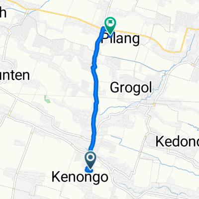
A cycling route starting in Tulangan Utara, East Java, Indonesia.
Overview
About this route
- 1 h 6 min
- Duration
- 18.4 km
- Distance
- 490 m
- Ascent
- 488 m
- Descent
- 16.6 km/h
- Avg. speed
- ---
- Max. altitude

Route quality
Waytypes & surfaces along the route
Waytypes
Road
5.9 km
(32 %)
Busy road
5.4 km
(29 %)
Surfaces
Paved
1.6 km
(9 %)
Asphalt
1.2 km
(7 %)
Paved (undefined)
0.4 km
(2 %)
Undefined
16.8 km
(91 %)
Continue with Bikemap
Use, edit, or download this cycling route
You would like to ride kntor or customize it for your own trip? Here is what you can do with this Bikemap route:
Free features
- Save this route as favorite or in collections
- Copy & plan your own version of this route
- Sync your route with Garmin or Wahoo
Premium features
Free trial for 3 days, or one-time payment. More about Bikemap Premium.
- Navigate this route on iOS & Android
- Export a GPX / KML file of this route
- Create your custom printout (try it for free)
- Download this route for offline navigation
Discover more Premium features.
Get Bikemap PremiumFrom our community
Other popular routes starting in Tulangan Utara
 Steady ride
- Distance
- 6 km
- Ascent
- 87 m
- Descent
- 129 m
- Location
- Tulangan Utara, East Java, Indonesia
 Jalan Raya Jaretan to Sawah, Kecamatan Wonoayu
- Distance
- 10.1 km
- Ascent
- 1,056 m
- Descent
- 1,056 m
- Location
- Tulangan Utara, East Java, Indonesia
 Ijen tatag dewe wani nek jare cah kae
- Distance
- 36.1 km
- Ascent
- 175 m
- Descent
- 174 m
- Location
- Tulangan Utara, East Java, Indonesia
 Jalan Raya Ploso 1932, Kecamatan Krembung to Jalan Pondok Buana 12, Kecamatan Sidoarjo
- Distance
- 16.8 km
- Ascent
- 76 m
- Descent
- 85 m
- Location
- Tulangan Utara, East Java, Indonesia
 Unnamed Road, Kecamatan Candi to Suko, Sidoarjo Sub-Distrcit
- Distance
- 2.4 km
- Ascent
- 10 m
- Descent
- 9 m
- Location
- Tulangan Utara, East Java, Indonesia
 Sawah, Kecamatan Wonoayu to Sawah, Kecamatan Wonoayu
- Distance
- 17.9 km
- Ascent
- 385 m
- Descent
- 399 m
- Location
- Tulangan Utara, East Java, Indonesia
 fight
fight- Distance
- 7.6 km
- Ascent
- 84 m
- Descent
- 86 m
- Location
- Tulangan Utara, East Java, Indonesia
 Griya Candi Pratama 21, Kecamatan Candi to Griya Candi Pratama 21, Kecamatan Candi
- Distance
- 12.8 km
- Ascent
- 33 m
- Descent
- 38 m
- Location
- Tulangan Utara, East Java, Indonesia
Open it in the app