

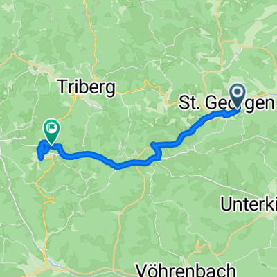
The Source of the Breg
A cycling route starting in Sankt Georgen im Schwarzwald, Baden-Wurttemberg, Germany.
Overview
About this route
Best rail access to the source of the Breg (and thus the source of the Danube).
- -:--
- Duration
- 67.8 km
- Distance
- 532 m
- Ascent
- 658 m
- Descent
- ---
- Avg. speed
- ---
- Max. altitude

Route quality
Waytypes & surfaces along the route
Waytypes
Track
22 km
(33 %)
Quiet road
13.9 km
(21 %)
Surfaces
Paved
42.3 km
(62 %)
Unpaved
20.8 km
(31 %)
Asphalt
41 km
(61 %)
Loose gravel
18.6 km
(27 %)
Continue with Bikemap
Use, edit, or download this cycling route
You would like to ride The Source of the Breg or customize it for your own trip? Here is what you can do with this Bikemap route:
Free features
- Save this route as favorite or in collections
- Copy & plan your own version of this route
- Sync your route with Garmin or Wahoo
Premium features
Free trial for 3 days, or one-time payment. More about Bikemap Premium.
- Navigate this route on iOS & Android
- Export a GPX / KML file of this route
- Create your custom printout (try it for free)
- Download this route for offline navigation
Discover more Premium features.
Get Bikemap PremiumFrom our community
Other popular routes starting in Sankt Georgen im Schwarzwald
 Peterzell vol_1 2020
- Distance
- 34.8 km
- Ascent
- 531 m
- Descent
- 535 m
- Location
- Sankt Georgen im Schwarzwald, Baden-Wurttemberg, Germany
 St.Georgen - Bad Urach
- Distance
- 291.4 km
- Ascent
- 2,872 m
- Descent
- 3,029 m
- Location
- Sankt Georgen im Schwarzwald, Baden-Wurttemberg, Germany
 22 august 2025
- Distance
- 16 km
- Ascent
- 400 m
- Descent
- 267 m
- Location
- Sankt Georgen im Schwarzwald, Baden-Wurttemberg, Germany
 Kesselberg - Villingen - Königsfeld
- Distance
- 46.8 km
- Ascent
- 639 m
- Descent
- 615 m
- Location
- Sankt Georgen im Schwarzwald, Baden-Wurttemberg, Germany
 Trening
- Distance
- 34.3 km
- Ascent
- 420 m
- Descent
- 429 m
- Location
- Sankt Georgen im Schwarzwald, Baden-Wurttemberg, Germany
 st georgen titisee feldberg
- Distance
- 60.9 km
- Ascent
- 1,024 m
- Descent
- 732 m
- Location
- Sankt Georgen im Schwarzwald, Baden-Wurttemberg, Germany
 MTB St. Georgen
- Distance
- 54.6 km
- Ascent
- 684 m
- Descent
- 1,055 m
- Location
- Sankt Georgen im Schwarzwald, Baden-Wurttemberg, Germany
 Einrollrunde über Königsfeld
- Distance
- 31.5 km
- Ascent
- 249 m
- Descent
- 249 m
- Location
- Sankt Georgen im Schwarzwald, Baden-Wurttemberg, Germany
Open it in the app