

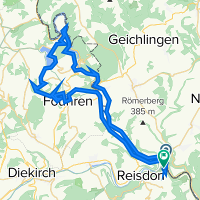
en chemin vers Echternach retour
A cycling route starting in Wallendorf, Rhineland-Palatinate, Germany.
Overview
About this route
- 50 min
- Duration
- 15.9 km
- Distance
- 69 m
- Ascent
- 52 m
- Descent
- 18.9 km/h
- Avg. speed
- ---
- Max. altitude

Route quality
Waytypes & surfaces along the route
Waytypes
Cycleway
14 km
(88 %)
Quiet road
1.4 km
(9 %)
Surfaces
Paved
15.7 km
(99 %)
Asphalt
15.4 km
(97 %)
Paved (undefined)
0.2 km
(1 %)
Continue with Bikemap
Use, edit, or download this cycling route
You would like to ride en chemin vers Echternach retour or customize it for your own trip? Here is what you can do with this Bikemap route:
Free features
- Save this route as favorite or in collections
- Copy & plan your own version of this route
- Sync your route with Garmin or Wahoo
Premium features
Free trial for 3 days, or one-time payment. More about Bikemap Premium.
- Navigate this route on iOS & Android
- Export a GPX / KML file of this route
- Create your custom printout (try it for free)
- Download this route for offline navigation
Discover more Premium features.
Get Bikemap PremiumFrom our community
Other popular routes starting in Wallendorf
 - echternach
- Distance
- 58.2 km
- Ascent
- 1,016 m
- Descent
- 1,090 m
- Location
- Wallendorf, Rhineland-Palatinate, Germany
 Wallendorf-Wasserbillig-Wormeldange
- Distance
- 55.1 km
- Ascent
- 444 m
- Descent
- 483 m
- Location
- Wallendorf, Rhineland-Palatinate, Germany
 - Vianden
- Distance
- 40.6 km
- Ascent
- 882 m
- Descent
- 837 m
- Location
- Wallendorf, Rhineland-Palatinate, Germany
 en chemin vers Echternach retour
- Distance
- 15.9 km
- Ascent
- 69 m
- Descent
- 52 m
- Location
- Wallendorf, Rhineland-Palatinate, Germany
 Flower Power naar Diekirch PC16
- Distance
- 12.1 km
- Ascent
- 84 m
- Descent
- 69 m
- Location
- Wallendorf, Rhineland-Palatinate, Germany
 Tourentipp Beaufort
- Distance
- 10.3 km
- Ascent
- 217 m
- Descent
- 218 m
- Location
- Wallendorf, Rhineland-Palatinate, Germany
 Radtour Trier - Koblenz
- Distance
- 247.4 km
- Ascent
- 90 m
- Descent
- 204 m
- Location
- Wallendorf, Rhineland-Palatinate, Germany
 20150822_111902.gpx
- Distance
- 16.4 km
- Ascent
- 242 m
- Descent
- 180 m
- Location
- Wallendorf, Rhineland-Palatinate, Germany
Open it in the app