Prze艂臋cze Beskidu 艢laskiego ;)
A cycling route starting in Buczkowice, Silesian Voivodeship, Poland.
Overview
About this route
Prze艂臋cze聽treningowe聽na g贸rala lub szose W tej wersji Salmopol, Kubalonka od zameczku, do ko艅ca szosy pod Przys艂op, przez Wis艂e Ustro艅 na R贸wnice i powr贸t na Salmopol polecam...
Tras臋 mo偶na dowolnie modyfikowa膰 np z Wis艂y Czarne 聽jest dobra szutrowa droga聽wzd艂u偶聽bia艂ej聽Wise艂ki聽na salmopol... ale nie przejecha艂em jeszcze tego odcinka w ca艂o艣ci trzeba by go sprawdzi膰聽poprawcie聽mnie jak聽si臋聽myle.
- -:--
- Duration
- 97.6 km
- Distance
- 1,855 m
- Ascent
- 1,855 m
- Descent
- ---
- Avg. speed
- ---
- Avg. speed
Route quality
Waytypes & surfaces along the route
Waytypes
Busy road
51 km
(52 %)
Road
17.4 km
(18 %)
Surfaces
Paved
82.2 km
(84 %)
Unpaved
0.2 km
(<1 %)
Asphalt
78.5 km
(80 %)
Paving stones
3.1 km
(3 %)
Route highlights
Points of interest along the route
Point of interest after 12.5 km
Point of interest after 14.5 km
Point of interest after 17.5 km
Point of interest after 34.6 km
Continue with Bikemap
Use, edit, or download this cycling route
You would like to ride Prze艂臋cze Beskidu 艢laskiego ;) or customize it for your own trip? Here is what you can do with this Bikemap route:
Free features
- Save this route as favorite or in collections
- Copy & plan your own version of this route
- Sync your route with Garmin or Wahoo
Premium features
Free trial for 3 days, or one-time payment. More about Bikemap Premium.
- Navigate this route on iOS & Android
- Export a GPX / KML file of this route
- Create your custom printout (try it for free)
- Download this route for offline navigation
Discover more Premium features.
Get Bikemap PremiumFrom our community
Other popular routes starting in Buczkowice
- wok贸艂 magury
- Distance
- 43.5 km
- Ascent
- 644 m
- Descent
- 702 m
- Location
- Buczkowice, Silesian Voivodeship, Poland
- P臋tla beskidzka
- Distance
- 80.5 km
- Ascent
- 1,446 m
- Descent
- 1,241 m
- Location
- Buczkowice, Silesian Voivodeship, Poland
- skrzyczne, krzyz, klimczok mod2
- Distance
- 39.7 km
- Ascent
- 1,352 m
- Descent
- 1,349 m
- Location
- Buczkowice, Silesian Voivodeship, Poland
- Buczkowice-Skrzyczne 艂atwiejsza
- Distance
- 14.5 km
- Ascent
- 0 m
- Descent
- 0 m
- Location
- Buczkowice, Silesian Voivodeship, Poland
- Buczkowice-Zapora Wapienica-Przegibek-Tresna-Buczkowice
- Distance
- 66.1 km
- Ascent
- 824 m
- Descent
- 824 m
- Location
- Buczkowice, Silesian Voivodeship, Poland
- Szczyrk Tour
- Distance
- 75.9 km
- Ascent
- 1,617 m
- Descent
- 1,617 m
- Location
- Buczkowice, Silesian Voivodeship, Poland
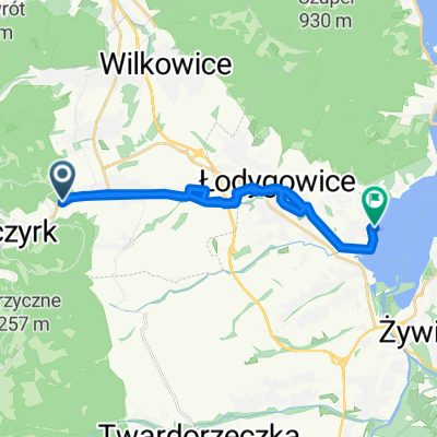
- Buczkowice Lodygowice Bystra Buczkowice
- Distance
- 26.8 km
- Ascent
- 276 m
- Descent
- 276 m
- Location
- Buczkowice, Silesian Voivodeship, Poland
- Beskidzka Petla 2017 project
- Distance
- 73.3 km
- Ascent
- 1,140 m
- Descent
- 1,140 m
- Location
- Buczkowice, Silesian Voivodeship, Poland
Open it in the app