

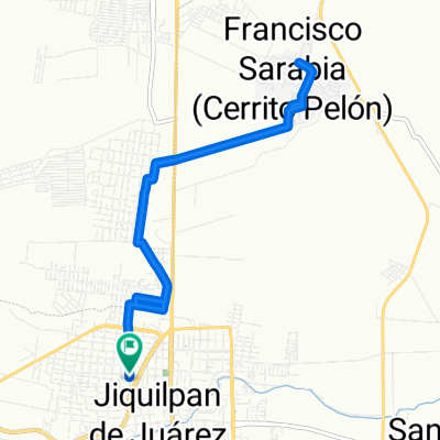
Ruta constante en Jiquilpan de Juárez
A cycling route starting in Jiquílpan de Juárez, State of Mexico, Mexico.
Overview
About this route
- 45 min
- Duration
- 10 km
- Distance
- 234 m
- Ascent
- 236 m
- Descent
- 13.3 km/h
- Avg. speed
- ---
- Max. altitude
Route photos

Route quality
Waytypes & surfaces along the route
Waytypes
Quiet road
6 km
(60 %)
Pedestrian area
1.2 km
(12 %)
Surfaces
Paved
0.4 km
(4 %)
Paved (undefined)
0.4 km
(4 %)
Undefined
9.6 km
(96 %)
Continue with Bikemap
Use, edit, or download this cycling route
You would like to ride Ruta constante en Jiquilpan de Juárez or customize it for your own trip? Here is what you can do with this Bikemap route:
Free features
- Save this route as favorite or in collections
- Copy & plan your own version of this route
- Sync your route with Garmin or Wahoo
Premium features
Free trial for 3 days, or one-time payment. More about Bikemap Premium.
- Navigate this route on iOS & Android
- Export a GPX / KML file of this route
- Create your custom printout (try it for free)
- Download this route for offline navigation
Discover more Premium features.
Get Bikemap PremiumFrom our community
Other popular routes starting in Jiquílpan de Juárez
 De Josefa Ortiz de Domínguez 30, San Martín Totolán a Avenida General Lázaro Cárdenas Norte
- Distance
- 2 km
- Ascent
- 7 m
- Descent
- 22 m
- Location
- Jiquílpan de Juárez, State of Mexico, Mexico
 De Calle J. Bautista López Sur 78, Jiquilpan de Juárez a Av. San Andres 2894, El Aguacate
- Distance
- 15.3 km
- Ascent
- 180 m
- Descent
- 111 m
- Location
- Jiquílpan de Juárez, State of Mexico, Mexico
 Ruta constante en Jiquilpan de Juárez
- Distance
- 10 km
- Ascent
- 234 m
- Descent
- 236 m
- Location
- Jiquílpan de Juárez, State of Mexico, Mexico
 De Melchor Ocampo a Melchor Ocampo
- Distance
- 13.4 km
- Ascent
- 127 m
- Descent
- 127 m
- Location
- Jiquílpan de Juárez, State of Mexico, Mexico
Open it in the app