

Pneu crevé 😭
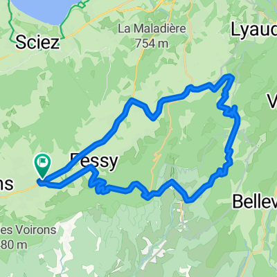
A cycling route starting in Bons-en-Chablais, Auvergne-Rhône-Alpes, France.
Overview
About this route
- 2 h 10 min
- Duration
- 61.1 km
- Distance
- 473 m
- Ascent
- 469 m
- Descent
- 28.1 km/h
- Avg. speed
- ---
- Max. altitude

Route quality
Waytypes & surfaces along the route
Waytypes
Road
20 km
(33 %)
Quiet road
19.3 km
(32 %)
Surfaces
Paved
52.6 km
(86 %)
Unpaved
0.5 km
(<1 %)
Asphalt
52.5 km
(86 %)
Gravel
0.3 km
(<1 %)
Continue with Bikemap
Use, edit, or download this cycling route
You would like to ride Pneu crevé 😭 or customize it for your own trip? Here is what you can do with this Bikemap route:
Free features
- Save this route as favorite or in collections
- Copy & plan your own version of this route
- Sync your route with Garmin or Wahoo
Premium features
Free trial for 3 days, or one-time payment. More about Bikemap Premium.
- Navigate this route on iOS & Android
- Export a GPX / KML file of this route
- Create your custom printout (try it for free)
- Download this route for offline navigation
Discover more Premium features.
Get Bikemap PremiumFrom our community
Other popular routes starting in Bons-en-Chablais
 frontaliers
- Distance
- 37.9 km
- Ascent
- 280 m
- Descent
- 290 m
- Location
- Bons-en-Chablais, Auvergne-Rhône-Alpes, France
 BikeComputer Training Session
- Distance
- 54.8 km
- Ascent
- 1,337 m
- Descent
- 1,782 m
- Location
- Bons-en-Chablais, Auvergne-Rhône-Alpes, France
 haut chablais
- Distance
- 37.2 km
- Ascent
- 888 m
- Descent
- 885 m
- Location
- Bons-en-Chablais, Auvergne-Rhône-Alpes, France
 Vallée Verte 10 Col Challenge
- Distance
- 80.2 km
- Ascent
- 1,811 m
- Descent
- 1,814 m
- Location
- Bons-en-Chablais, Auvergne-Rhône-Alpes, France
 Supersaxel-Tête du Char-Col de Cou
- Distance
- 7.4 km
- Ascent
- 292 m
- Descent
- 298 m
- Location
- Bons-en-Chablais, Auvergne-Rhône-Alpes, France
 Bons-en-Chablais Ramaz
- Distance
- 117.4 km
- Ascent
- 1,941 m
- Descent
- 1,941 m
- Location
- Bons-en-Chablais, Auvergne-Rhône-Alpes, France
 Grimpée des Voirons 2022
- Distance
- 14.9 km
- Ascent
- 836 m
- Descent
- 19 m
- Location
- Bons-en-Chablais, Auvergne-Rhône-Alpes, France
 Col de cou
- Distance
- 32.1 km
- Ascent
- 762 m
- Descent
- 762 m
- Location
- Bons-en-Chablais, Auvergne-Rhône-Alpes, France
Open it in the app