

3august2019
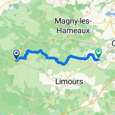
A cycling route starting in Cernay-la-Ville, Île-de-France Region, France.
Overview
About this route
- 4 h 12 min
- Duration
- 32 km
- Distance
- 300 m
- Ascent
- 303 m
- Descent
- 7.6 km/h
- Avg. speed
- ---
- Max. altitude

Route quality
Waytypes & surfaces along the route
Waytypes
Road
5.8 km
(18 %)
Track
3.5 km
(11 %)
Surfaces
Paved
23.4 km
(73 %)
Unpaved
1 km
(3 %)
Asphalt
20.8 km
(65 %)
Paved (undefined)
2.6 km
(8 %)
Continue with Bikemap
Use, edit, or download this cycling route
You would like to ride 3august2019 or customize it for your own trip? Here is what you can do with this Bikemap route:
Free features
- Save this route as favorite or in collections
- Copy & plan your own version of this route
- Sync your route with Garmin or Wahoo
Premium features
Free trial for 3 days, or one-time payment. More about Bikemap Premium.
- Navigate this route on iOS & Android
- Export a GPX / KML file of this route
- Create your custom printout (try it for free)
- Download this route for offline navigation
Discover more Premium features.
Get Bikemap PremiumFrom our community
Other popular routes starting in Cernay-la-Ville
 Itinéraire confortable en Gometz-le-Châtel
- Distance
- 18.2 km
- Ascent
- 173 m
- Descent
- 140 m
- Location
- Cernay-la-Ville, Île-de-France Region, France
 VTT Cernaysienne 2K9
- Distance
- 27.2 km
- Ascent
- 281 m
- Descent
- 281 m
- Location
- Cernay-la-Ville, Île-de-France Region, France
 Itinéraire modéré en Choisel
- Distance
- 5.8 km
- Ascent
- 22 m
- Descent
- 97 m
- Location
- Cernay-la-Ville, Île-de-France Region, France
 3august2019
- Distance
- 32 km
- Ascent
- 300 m
- Descent
- 303 m
- Location
- Cernay-la-Ville, Île-de-France Region, France
 Rambouillet
- Distance
- 99.8 km
- Ascent
- 789 m
- Descent
- 793 m
- Location
- Cernay-la-Ville, Île-de-France Region, France
 Rue de Rambouillet, Cernay-la-Ville à 20 Rue de Saint-Martin, Saint-Martin-de-Nigelles
- Distance
- 32.8 km
- Ascent
- 282 m
- Descent
- 341 m
- Location
- Cernay-la-Ville, Île-de-France Region, France
 Cernay la ville - Epernon (day 2 to Chartres)
- Distance
- 32.7 km
- Ascent
- 342 m
- Descent
- 213 m
- Location
- Cernay-la-Ville, Île-de-France Region, France
 De Route Forestière des Cinq Cents Arpents, Senlisse à Rue des Étangs 10, Coignières
- Distance
- 11.4 km
- Ascent
- 126 m
- Descent
- 137 m
- Location
- Cernay-la-Ville, Île-de-France Region, France
Open it in the app