Kalnikom i podkalničkim krajem
A cycling route starting in Ljubešćica, Varaždin County, Croatia.
Overview
About this route
A moderately challenging route passing through the southern Podkalnik area, including a tour of the old town of Kalnik and the Kalnik plateau towards the northern side to Varaždinske Toplice, then back on a new road to Sudovec from where we started.
- -:--
- Duration
- 49.4 km
- Distance
- 768 m
- Ascent
- 751 m
- Descent
- ---
- Avg. speed
- ---
- Max. altitude
Route highlights
Points of interest along the route

Point of interest after 6.5 km
Ej, Neno
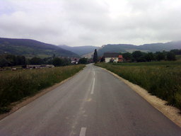
Point of interest after 6.7 km
Prema Hižanovcu

Photo after 8.9 km
Pogled do...

Photo after 9 km
Jedna od crkvica na bregu
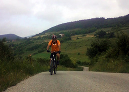
Photo after 9.3 km
Fini uspon je iza nas

Point of interest after 9.5 km
Kalnik u oblacima

Photo after 12.4 km
Stari grad

Point of interest after 12.5 km
Stari grad se obnavlja

Point of interest after 14.9 km
Idila 1

Point of interest after 15 km
Idila 2

Point of interest after 15.7 km
Svako malo pukne pogled

Point of interest after 16 km
Savršeni, široki makadam

Point of interest after 16.9 km
Idila 3

Point of interest after 17.5 km
Iza vrha Kalnika

Photo after 18.6 km
Kroz šumu

Point of interest after 19.4 km
Sve piše

Point of interest after 19.6 km
Potok Ruškovec

Point of interest after 19.7 km
Mostić

Point of interest after 19.7 km
Raspelo i kip Majke Božje u Ruškovcu

Point of interest after 19.7 km
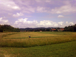
Point of interest after 25.3 km
Prema Ljubeščici
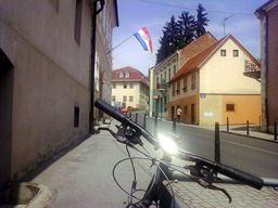
Photo after 32.5 km
Varaždinske Toplice

Point of interest after 39.1 km
Kriva cesta :)

Point of interest after 42.3 km
Ispod Autoceste

Point of interest after 42.9 km
Lijevo je zatvoreno, ali baš tu idemo

Point of interest after 44.2 km
Mljac :)

Point of interest after 45.2 km
Nova, novcata cesta a zatvorena za promet
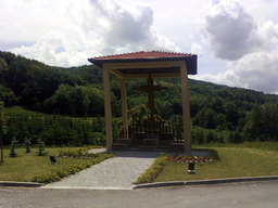
Point of interest after 45.2 km
Raspelo kraj nove ceste

Point of interest after 45.5 km
Ugodna vožnja u sjeni

Point of interest after 46.3 km
Sorry ak se dobro ne vidi: biciklist-strašilo
Continue with Bikemap
Use, edit, or download this cycling route
You would like to ride Kalnikom i podkalničkim krajem or customize it for your own trip? Here is what you can do with this Bikemap route:
Free features
- Save this route as favorite or in collections
- Copy & plan your own version of this route
- Sync your route with Garmin or Wahoo
Premium features
Free trial for 3 days, or one-time payment. More about Bikemap Premium.
- Navigate this route on iOS & Android
- Export a GPX / KML file of this route
- Create your custom printout (try it for free)
- Download this route for offline navigation
Discover more Premium features.
Get Bikemap PremiumFrom our community
Other popular routes starting in Ljubešćica
 before - oujea, after - kaj je meni ovo trebalo
- Distance
- 473.6 km
- Ascent
- 1,749 m
- Descent
- 1,969 m
- Location
- Ljubešćica, Varaždin County, Croatia
 Biciklom oko Kalnika od kleti i nazad
- Distance
- 22.8 km
- Ascent
- 469 m
- Descent
- 484 m
- Location
- Ljubešćica, Varaždin County, Croatia
 Vž.Toplice - Čakovec via jezero
- Distance
- 29.7 km
- Ascent
- 139 m
- Descent
- 161 m
- Location
- Ljubešćica, Varaždin County, Croatia
 Var. Toplice-Kalnički Ljubelj
- Distance
- 14 km
- Ascent
- 239 m
- Descent
- 134 m
- Location
- Ljubešćica, Varaždin County, Croatia
 Kalnik_Picelj
- Distance
- 164.5 km
- Ascent
- 7,141 m
- Descent
- 7,359 m
- Location
- Ljubešćica, Varaždin County, Croatia
 Vz Toplice Kalnik 2
- Distance
- 13.6 km
- Ascent
- 559 m
- Descent
- 275 m
- Location
- Ljubešćica, Varaždin County, Croatia
 Vratno kruzna
- Distance
- 17 km
- Ascent
- 321 m
- Descent
- 319 m
- Location
- Ljubešćica, Varaždin County, Croatia
 Kalnik 10.5.2020
- Distance
- 15.8 km
- Ascent
- 667 m
- Descent
- 668 m
- Location
- Ljubešćica, Varaždin County, Croatia
Open it in the app


