Test Route E-Bike
A cycling route starting in Hägendorf, Canton of Solothurn, Switzerland.
Overview
About this route
- -:--
- Duration
- 50.3 km
- Distance
- 930 m
- Ascent
- 875 m
- Descent
- ---
- Avg. speed
- ---
- Avg. speed
Route quality
Waytypes & surfaces along the route
Waytypes
Quiet road
27 km
(54 %)
Busy road
10.9 km
(22 %)
Surfaces
Paved
33.5 km
(67 %)
Unpaved
2.4 km
(5 %)
Asphalt
31.3 km
(62 %)
Paved (undefined)
2.2 km
(4 %)
Continue with Bikemap
Use, edit, or download this cycling route
You would like to ride Test Route E-Bike or customize it for your own trip? Here is what you can do with this Bikemap route:
Free features
- Save this route as favorite or in collections
- Copy & plan your own version of this route
- Sync your route with Garmin or Wahoo
Premium features
Free trial for 3 days, or one-time payment. More about Bikemap Premium.
- Navigate this route on iOS & Android
- Export a GPX / KML file of this route
- Create your custom printout (try it for free)
- Download this route for offline navigation
Discover more Premium features.
Get Bikemap PremiumFrom our community
Other popular routes starting in Hägendorf
- Chasseral Mt.Crosin Schelten Chilchzimmer
- Distance
- 208.9 km
- Ascent
- 2,754 m
- Descent
- 2,754 m
- Location
- Hägendorf, Canton of Solothurn, Switzerland
- Hägendorf Staffelegg Scherz Hägendorf
- Distance
- 91 km
- Ascent
- 864 m
- Descent
- 864 m
- Location
- Hägendorf, Canton of Solothurn, Switzerland
- Moderate Route in Hägendorf
- Distance
- 39.7 km
- Ascent
- 133 m
- Descent
- 134 m
- Location
- Hägendorf, Canton of Solothurn, Switzerland
- Nellenacker 45, Hägendorf nach Bühlweg 1, Hägendorf
- Distance
- 30.6 km
- Ascent
- 217 m
- Descent
- 201 m
- Location
- Hägendorf, Canton of Solothurn, Switzerland
- Letzte Etappe Bodensee Rundfahrt
- Distance
- 45.6 km
- Ascent
- 185 m
- Descent
- 110 m
- Location
- Hägendorf, Canton of Solothurn, Switzerland
- Langenbruckstrasse 17, Hägendorf nach Langenbruckstrasse 10, Hägendorf
- Distance
- 24.7 km
- Ascent
- 589 m
- Descent
- 585 m
- Location
- Hägendorf, Canton of Solothurn, Switzerland
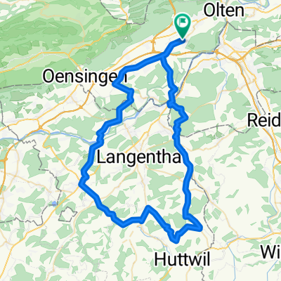
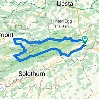
- BaselbietOst mit Passwang
- Distance
- 99.2 km
- Ascent
- 1,808 m
- Descent
- 1,808 m
- Location
- Hägendorf, Canton of Solothurn, Switzerland
- oberer Hauenstein Baselbiet Benkerjoch
- Distance
- 104.5 km
- Ascent
- 1,376 m
- Descent
- 1,376 m
- Location
- Hägendorf, Canton of Solothurn, Switzerland
Open it in the app