

Solo Jogle Day 2
A cycling route starting in Tain, Scotland, United Kingdom.
Overview
About this route
Solo Jogle
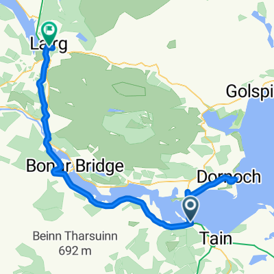
Day 2
From Tain to Fort Augustus
Campsite: Cumberlands Campsite
- -:--
- Duration
- 109.9 km
- Distance
- 724 m
- Ascent
- 714 m
- Descent
- ---
- Avg. speed
- ---
- Max. altitude

Continue with Bikemap
Use, edit, or download this cycling route
You would like to ride Solo Jogle Day 2 or customize it for your own trip? Here is what you can do with this Bikemap route:
Free features
- Save this route as favorite or in collections
- Copy & plan your own version of this route
- Split it into stages to create a multi-day tour
- Sync your route with Garmin or Wahoo
Premium features
Free trial for 3 days, or one-time payment. More about Bikemap Premium.
- Navigate this route on iOS & Android
- Export a GPX / KML file of this route
- Create your custom printout (try it for free)
- Download this route for offline navigation
Discover more Premium features.
Get Bikemap PremiumFrom our community
Other popular routes starting in Tain
 Jog2LE Day Two
- Distance
- 140.2 km
- Ascent
- 669 m
- Descent
- 633 m
- Location
- Tain, Scotland, United Kingdom
 D3New
D3New- Distance
- 148.5 km
- Ascent
- 945 m
- Descent
- 762 m
- Location
- Tain, Scotland, United Kingdom
 Alness to Tain pilgrim route
- Distance
- 9.4 km
- Ascent
- 55 m
- Descent
- 126 m
- Location
- Tain, Scotland, United Kingdom
 08_Tain-Lairg_2016-06-26
- Distance
- 63.6 km
- Ascent
- 255 m
- Descent
- 168 m
- Location
- Tain, Scotland, United Kingdom
 JOGLE 18-7-11 day2 Y
- Distance
- 167.9 km
- Ascent
- 591 m
- Descent
- 576 m
- Location
- Tain, Scotland, United Kingdom
 Tain Cycling
- Distance
- 59.7 km
- Ascent
- 452 m
- Descent
- 501 m
- Location
- Tain, Scotland, United Kingdom
 Morangie Forest circular
- Distance
- 19.8 km
- Ascent
- 243 m
- Descent
- 243 m
- Location
- Tain, Scotland, United Kingdom
 Solo Jogle Day 2
- Distance
- 109.9 km
- Ascent
- 724 m
- Descent
- 714 m
- Location
- Tain, Scotland, United Kingdom
Open it in the app