

Lüneburger Heide: Wilseder Berg
A cycling route starting in Bispingen, Lower Saxony, Germany.
Overview
About this route
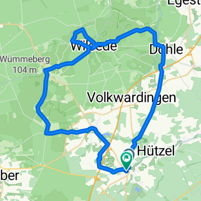
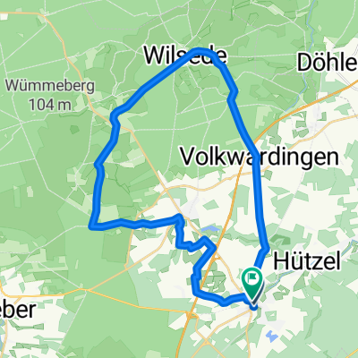
Behringen is the starting point of this circular tour. You reach Hof Tütsberg through meadows and fields. A sandy path follows to the right of the Tüts- and Wulfsberg and opens up the view to vast heathlands. Well-drivable paths lead to Oberhaverbeck. The path over the Bolterberg up to just before the Wilseder Berg is narrow. Natural and easy to ride, the route goes along the Heidschnuckenweg to Döhle. On excellent asphalt, you reach the settlement of Brocken. It rolls leisurely to Borsteler Schweiz. Here you have the choice between a single trail with a view or calmly bypassing the basin on asphalt. Silvery from the setting sun, the Brunausee shimmers at the end of the tour.
- -:--
- Duration
- 86.7 km
- Distance
- 374 m
- Ascent
- 371 m
- Descent
- ---
- Avg. speed
- ---
- Max. altitude

Route quality
Waytypes & surfaces along the route
Waytypes
Path
34.7 km
(40 %)
Track
30.3 km
(35 %)
Surfaces
Paved
24.3 km
(28 %)
Unpaved
45.1 km
(52 %)
Ground
18.2 km
(21 %)
Asphalt
17.3 km
(20 %)
Continue with Bikemap
Use, edit, or download this cycling route
You would like to ride Lüneburger Heide: Wilseder Berg or customize it for your own trip? Here is what you can do with this Bikemap route:
Free features
- Save this route as favorite or in collections
- Copy & plan your own version of this route
- Split it into stages to create a multi-day tour
- Sync your route with Garmin or Wahoo
Premium features
Free trial for 3 days, or one-time payment. More about Bikemap Premium.
- Navigate this route on iOS & Android
- Export a GPX / KML file of this route
- Create your custom printout (try it for free)
- Download this route for offline navigation
Discover more Premium features.
Get Bikemap PremiumFrom our community
Other popular routes starting in Bispingen
 test
test- Distance
- 25.5 km
- Ascent
- 163 m
- Descent
- 160 m
- Location
- Bispingen, Lower Saxony, Germany
 Rundtour Lüneburger Heide
- Distance
- 38.3 km
- Ascent
- 271 m
- Descent
- 263 m
- Location
- Bispingen, Lower Saxony, Germany
 Bispingen-Hannibals Grab
- Distance
- 28.7 km
- Ascent
- 152 m
- Descent
- 147 m
- Location
- Bispingen, Lower Saxony, Germany
 Bispingen-Steinbeck-Volkwardingen-Totengrund-Bispingen
- Distance
- 27.3 km
- Ascent
- 145 m
- Descent
- 148 m
- Location
- Bispingen, Lower Saxony, Germany
 gut2 bispingen
- Distance
- 19.5 km
- Ascent
- 111 m
- Descent
- 109 m
- Location
- Bispingen, Lower Saxony, Germany
 Celle - Uelzen
- Distance
- 56.5 km
- Ascent
- 249 m
- Descent
- 284 m
- Location
- Bispingen, Lower Saxony, Germany
 Wd07-Pietzmoor-Osterheide-53km
- Distance
- 53.2 km
- Ascent
- 361 m
- Descent
- 359 m
- Location
- Bispingen, Lower Saxony, Germany
 Wd06-Kleine-Heidetour-27km
- Distance
- 27.2 km
- Ascent
- 204 m
- Descent
- 196 m
- Location
- Bispingen, Lower Saxony, Germany
Open it in the app