

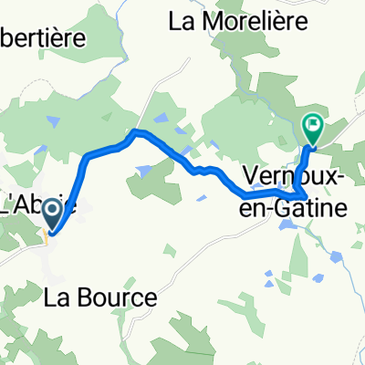
to doué
A cycling route starting in Moncoutant, Nouvelle-Aquitaine, France.
Overview
About this route
- -:--
- Duration
- 74.7 km
- Distance
- 254 m
- Ascent
- 372 m
- Descent
- ---
- Avg. speed
- ---
- Max. altitude

Route quality
Waytypes & surfaces along the route
Waytypes
Road
45 km
(60 %)
Quiet road
24.2 km
(32 %)
Surfaces
Paved
4.9 km
(6 %)
Unpaved
3.8 km
(5 %)
Asphalt
4.8 km
(6 %)
Pebblestone
3.8 km
(5 %)
Continue with Bikemap
Use, edit, or download this cycling route
You would like to ride to doué or customize it for your own trip? Here is what you can do with this Bikemap route:
Free features
- Save this route as favorite or in collections
- Copy & plan your own version of this route
- Sync your route with Garmin or Wahoo
Premium features
Free trial for 3 days, or one-time payment. More about Bikemap Premium.
- Navigate this route on iOS & Android
- Export a GPX / KML file of this route
- Create your custom printout (try it for free)
- Download this route for offline navigation
Discover more Premium features.
Get Bikemap PremiumFrom our community
Other popular routes starting in Moncoutant
 Rue de la Morinière 56, L'Absie to L'Alleron, Largeasse
- Distance
- 7.8 km
- Ascent
- 74 m
- Descent
- 144 m
- Location
- Moncoutant, Nouvelle-Aquitaine, France
 De La Maupetitière 4, Moncoutant-sur-Sèvre à La Maupetitière 4, Moncoutant-sur-Sèvre
- Distance
- 23.8 km
- Ascent
- 189 m
- Descent
- 190 m
- Location
- Moncoutant, Nouvelle-Aquitaine, France
 La Gatine
- Distance
- 48.5 km
- Ascent
- 452 m
- Descent
- 450 m
- Location
- Moncoutant, Nouvelle-Aquitaine, France
 Itinéraire reposant en Le Breuil-Bernard
- Distance
- 16.5 km
- Ascent
- 66 m
- Descent
- 79 m
- Location
- Moncoutant, Nouvelle-Aquitaine, France
 trip left to go
- Distance
- 477.8 km
- Ascent
- 386 m
- Descent
- 502 m
- Location
- Moncoutant, Nouvelle-Aquitaine, France
 Voie verte Moncoutant - Bressuire
- Distance
- 15.3 km
- Ascent
- 74 m
- Descent
- 89 m
- Location
- Moncoutant, Nouvelle-Aquitaine, France
 L'Absie - Angouleme
- Distance
- 148.1 km
- Ascent
- 432 m
- Descent
- 625 m
- Location
- Moncoutant, Nouvelle-Aquitaine, France
 Itinéraire à grande vitesse en Pugny
- Distance
- 32 km
- Ascent
- 480 m
- Descent
- 494 m
- Location
- Moncoutant, Nouvelle-Aquitaine, France
Open it in the app