

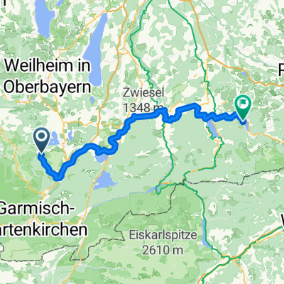
Grafenaschau - untern Stierkopf
A cycling route starting in Schwaigen, Bavaria, Germany.
Overview
About this route
Not tested
- -:--
- Duration
- 8.7 km
- Distance
- 724 m
- Ascent
- 47 m
- Descent
- ---
- Avg. speed
- ---
- Max. altitude

Continue with Bikemap
Use, edit, or download this cycling route
You would like to ride Grafenaschau - untern Stierkopf or customize it for your own trip? Here is what you can do with this Bikemap route:
Free features
- Save this route as favorite or in collections
- Copy & plan your own version of this route
- Sync your route with Garmin or Wahoo
Premium features
Free trial for 3 days, or one-time payment. More about Bikemap Premium.
- Navigate this route on iOS & Android
- Export a GPX / KML file of this route
- Create your custom printout (try it for free)
- Download this route for offline navigation
Discover more Premium features.
Get Bikemap PremiumFrom our community
Other popular routes starting in Schwaigen
 Grafenaschau - Jochalm
- Distance
- 38 km
- Ascent
- 1,164 m
- Descent
- 447 m
- Location
- Schwaigen, Bavaria, Germany
 Grafenaschau
- Distance
- 12.7 km
- Ascent
- 547 m
- Descent
- 546 m
- Location
- Schwaigen, Bavaria, Germany
 Schwaigen - Schliersee
- Distance
- 92.7 km
- Ascent
- 1,150 m
- Descent
- 989 m
- Location
- Schwaigen, Bavaria, Germany
 Waldparkplatz bei Grafenaschau nach Bad Kohlgrub
- Distance
- 6.4 km
- Ascent
- 206 m
- Descent
- 21 m
- Location
- Schwaigen, Bavaria, Germany
 Hörnleweg 3, Schwaigen nach Ramsachstraße 2, Murnau am Staffelsee
- Distance
- 9.2 km
- Ascent
- 0 m
- Descent
- 4 m
- Location
- Schwaigen, Bavaria, Germany
 Grafenaschau - Farchant
- Distance
- 20 km
- Ascent
- 95 m
- Descent
- 101 m
- Location
- Schwaigen, Bavaria, Germany
 Grafenaschau - untern Stierkopf
- Distance
- 8.7 km
- Ascent
- 724 m
- Descent
- 47 m
- Location
- Schwaigen, Bavaria, Germany
 Kunst und Kultur Querverbindung Gauting-Murnau via Starnberger See
- Distance
- 72.1 km
- Ascent
- 6,729 m
- Descent
- 6,810 m
- Location
- Schwaigen, Bavaria, Germany
Open it in the app