

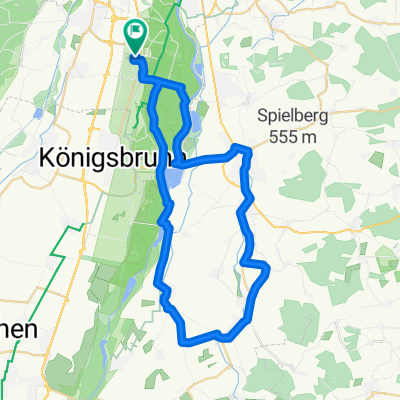
Dahoam
A cycling route starting in Königsbrunn, Bavaria, Germany.
Overview
About this route
- 3 h 10 min
- Duration
- 50.4 km
- Distance
- 465 m
- Ascent
- 462 m
- Descent
- 15.9 km/h
- Avg. speed
- ---
- Max. altitude

Route quality
Waytypes & surfaces along the route
Waytypes
Path
16.6 km
(33 %)
Quiet road
14.6 km
(29 %)
Surfaces
Paved
31.3 km
(62 %)
Unpaved
14.1 km
(28 %)
Asphalt
31.3 km
(62 %)
Gravel
9.6 km
(19 %)
Continue with Bikemap
Use, edit, or download this cycling route
You would like to ride Dahoam or customize it for your own trip? Here is what you can do with this Bikemap route:
Free features
- Save this route as favorite or in collections
- Copy & plan your own version of this route
- Sync your route with Garmin or Wahoo
Premium features
Free trial for 3 days, or one-time payment. More about Bikemap Premium.
- Navigate this route on iOS & Android
- Export a GPX / KML file of this route
- Create your custom printout (try it for free)
- Download this route for offline navigation
Discover more Premium features.
Get Bikemap PremiumFrom our community
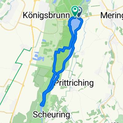
Other popular routes starting in Königsbrunn
 Donauwörther Straße 32C, Königsbrunn nach Eching am Ammersee
- Distance
- 44.9 km
- Ascent
- 273 m
- Descent
- 253 m
- Location
- Königsbrunn, Bavaria, Germany
 Haunstetten-egling-mering
- Distance
- 47.1 km
- Ascent
- 130 m
- Descent
- 126 m
- Location
- Königsbrunn, Bavaria, Germany
 Route zu Wassersportcenter Mandichosee
- Distance
- 24.8 km
- Ascent
- 37 m
- Descent
- 34 m
- Location
- Königsbrunn, Bavaria, Germany
 Augsburg-Ammersee-Kuhsee
- Distance
- 114.2 km
- Ascent
- 484 m
- Descent
- 488 m
- Location
- Königsbrunn, Bavaria, Germany
 Inningen-Oberschönenfeld
- Distance
- 61.9 km
- Ascent
- 450 m
- Descent
- 449 m
- Location
- Königsbrunn, Bavaria, Germany
 Haunstetten-Staustufe 22
- Distance
- 25.1 km
- Ascent
- 46 m
- Descent
- 44 m
- Location
- Königsbrunn, Bavaria, Germany
 VIA CLAUDIA
- Distance
- 440.7 km
- Ascent
- 1,578 m
- Descent
- 1,885 m
- Location
- Königsbrunn, Bavaria, Germany
 5. Etappe: Königsbrunn nach Kinsau
- Distance
- 73.1 km
- Ascent
- 369 m
- Descent
- 137 m
- Location
- Königsbrunn, Bavaria, Germany
Open it in the app