

Rund matrand
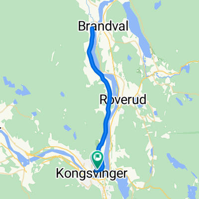
A cycling route starting in Kongsvinger, Hedmark, Norway.
Overview
About this route
- 3 h 43 min
- Duration
- 38.4 km
- Distance
- 327 m
- Ascent
- 321 m
- Descent
- 10.3 km/h
- Avg. speed
- ---
- Max. altitude

Route photos


Route quality
Waytypes & surfaces along the route
Waytypes
Road
17.3 km
(45 %)
Quiet road
3.1 km
(8 %)
Surfaces
Paved
15.4 km
(40 %)
Unpaved
21.9 km
(57 %)
Gravel
20.3 km
(53 %)
Asphalt
15.4 km
(40 %)
Continue with Bikemap
Use, edit, or download this cycling route
You would like to ride Rund matrand or customize it for your own trip? Here is what you can do with this Bikemap route:
Free features
- Save this route as favorite or in collections
- Copy & plan your own version of this route
- Sync your route with Garmin or Wahoo
Premium features
Free trial for 3 days, or one-time payment. More about Bikemap Premium.
- Navigate this route on iOS & Android
- Export a GPX / KML file of this route
- Create your custom printout (try it for free)
- Download this route for offline navigation
Discover more Premium features.
Get Bikemap PremiumFrom our community
Other popular routes starting in Kongsvinger
 Rund matrand
- Distance
- 38.4 km
- Ascent
- 327 m
- Descent
- 321 m
- Location
- Kongsvinger, Hedmark, Norway
 NM 2019 Ksenior
- Distance
- 29.6 km
- Ascent
- 85 m
- Descent
- 76 m
- Location
- Kongsvinger, Hedmark, Norway

EDGE 1030®
Kongsvinger Cycling- Distance
- 103 km
- Ascent
- 634 m
- Descent
- 781 m
- Location
- Kongsvinger, Hedmark, Norway
 kongsvinger charlottenberg
- Distance
- 116.3 km
- Ascent
- 0 m
- Descent
- 0 m
- Location
- Kongsvinger, Hedmark, Norway
 Fesnigsrittet Etapa 2
- Distance
- 196.5 km
- Ascent
- 0 m
- Descent
- 0 m
- Location
- Kongsvinger, Hedmark, Norway
 GT Norway Stage 0
- Distance
- 8.3 km
- Ascent
- 375 m
- Descent
- 138 m
- Location
- Kongsvinger, Hedmark, Norway
 Etapa 1: Festningsrittet
- Distance
- 139.4 km
- Ascent
- 0 m
- Descent
- 0 m
- Location
- Kongsvinger, Hedmark, Norway
 Über Täler u.Berge von Masterud(N) nach Ekshärad(S)
- Distance
- 133.8 km
- Ascent
- 939 m
- Descent
- 951 m
- Location
- Kongsvinger, Hedmark, Norway
Open it in the app