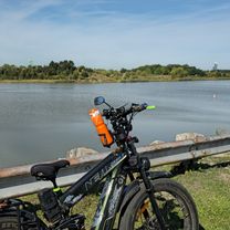
Easy ride in Mississauga
A cycling route starting in Etobicoke, Ontario, Canada.
Overview
About this route
- 45 min
- Duration
- 13.7 km
- Distance
- 33 m
- Ascent
- 12 m
- Descent
- 18.5 km/h
- Avg. speed
- ---
- Avg. speed
Route photos
Route quality
Waytypes & surfaces along the route
Waytypes
Cycleway
6 km
(44 %)
Quiet road
4.4 km
(32 %)
Surfaces
Paved
13.3 km
(97 %)
Asphalt
12.4 km
(90 %)
Concrete
0.7 km
(5 %)
Continue with Bikemap
Use, edit, or download this cycling route
You would like to ride Easy ride in Mississauga or customize it for your own trip? Here is what you can do with this Bikemap route:
Free features
- Save this route as favorite or in collections
- Copy & plan your own version of this route
- Sync your route with Garmin or Wahoo
Premium features
Free trial for 3 days, or one-time payment. More about Bikemap Premium.
- Navigate this route on iOS & Android
- Export a GPX / KML file of this route
- Create your custom printout (try it for free)
- Download this route for offline navigation
Discover more Premium features.
Get Bikemap PremiumFrom our community
Other popular routes starting in Etobicoke
- From Etobicoke to Niagara Falls
- Distance
- 134.4 km
- Ascent
- 472 m
- Descent
- 435 m
- Location
- Etobicoke, Ontario, Canada
- Humber - Eg - Royal York
- Distance
- 14.4 km
- Ascent
- 93 m
- Descent
- 93 m
- Location
- Etobicoke, Ontario, Canada
- Kipling station to Clarkson GO via Etobicoke Creek, Lakeshore,
- Distance
- 24.3 km
- Ascent
- 107 m
- Descent
- 136 m
- Location
- Etobicoke, Ontario, Canada
- Humber North
- Distance
- 5.9 km
- Ascent
- 26 m
- Descent
- 15 m
- Location
- Etobicoke, Ontario, Canada
- Relaxed route in Toronto
- Distance
- 16.9 km
- Ascent
- 0 m
- Descent
- 0 m
- Location
- Etobicoke, Ontario, Canada
- Malton GO to Union Via West Humber River Trial and High Park Zoo
- Distance
- 43.5 km
- Ascent
- 285 m
- Descent
- 366 m
- Location
- Etobicoke, Ontario, Canada
- Day1_Mississauga to Etobicoke
- Distance
- 10.4 km
- Ascent
- 50 m
- Descent
- 66 m
- Location
- Etobicoke, Ontario, Canada
- Old Mill Return Via Humber River, Duck Pond, Centennial Park Conservatory, Etobicoke Creek, Lakeshore
- Distance
- 39.8 km
- Ascent
- 320 m
- Descent
- 303 m
- Location
- Etobicoke, Ontario, Canada