
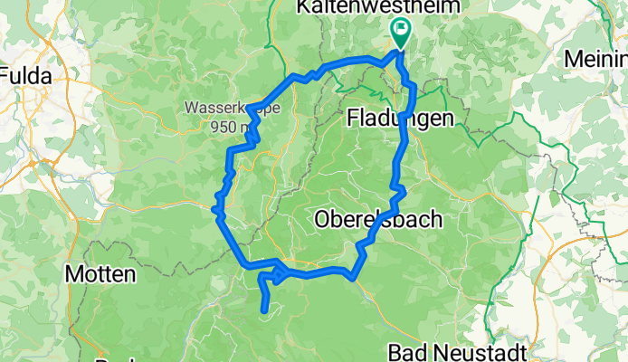
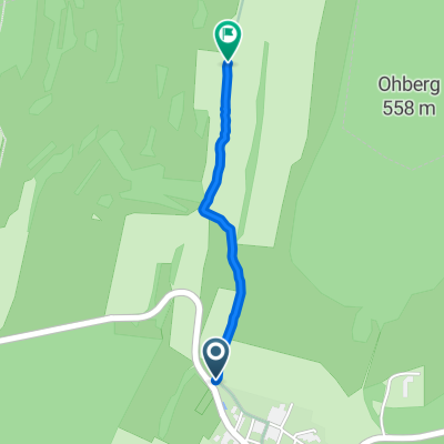
P&J-Rhön-2019
A cycling route starting in Erbenhausen, Thuringia, Germany.
Overview
About this route
- 7 h 15 min
- Duration
- 88.7 km
- Distance
- 2,051 m
- Ascent
- 2,051 m
- Descent
- 12.2 km/h
- Avg. speed
- ---
- Max. altitude
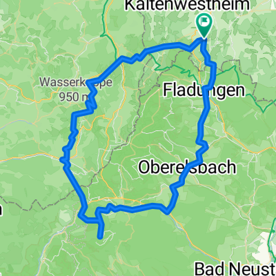
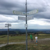
Route photos

Route quality
Waytypes & surfaces along the route
Waytypes
Track
31 km
(35 %)
Road
23.9 km
(27 %)
Surfaces
Paved
63 km
(71 %)
Unpaved
16.9 km
(19 %)
Asphalt
59.4 km
(67 %)
Gravel
11.5 km
(13 %)
Continue with Bikemap
Use, edit, or download this cycling route
You would like to ride P&J-Rhön-2019 or customize it for your own trip? Here is what you can do with this Bikemap route:
Free features
- Save this route as favorite or in collections
- Copy & plan your own version of this route
- Split it into stages to create a multi-day tour
- Sync your route with Garmin or Wahoo
Premium features
Free trial for 3 days, or one-time payment. More about Bikemap Premium.
- Navigate this route on iOS & Android
- Export a GPX / KML file of this route
- Create your custom printout (try it for free)
- Download this route for offline navigation
Discover more Premium features.
Get Bikemap PremiumFrom our community
Other popular routes starting in Erbenhausen
 Rhön
Rhön- Distance
- 83.4 km
- Ascent
- 1,866 m
- Descent
- 1,866 m
- Location
- Erbenhausen, Thuringia, Germany
 Erbenhausen - Sand
- Distance
- 109.2 km
- Ascent
- 580 m
- Descent
- 813 m
- Location
- Erbenhausen, Thuringia, Germany
 Schafhäuser Straße nach Obertor
- Distance
- 26.1 km
- Ascent
- 290 m
- Descent
- 336 m
- Location
- Erbenhausen, Thuringia, Germany
 P&J-Rhön-2019
- Distance
- 88.7 km
- Ascent
- 2,051 m
- Descent
- 2,051 m
- Location
- Erbenhausen, Thuringia, Germany
 Route im Schneckentempo in Erbenhausen
- Distance
- 1 km
- Ascent
- 32 m
- Descent
- 0 m
- Location
- Erbenhausen, Thuringia, Germany
 Lindenstraße 5, Erbenhausen nach Theo-Neubauer-Straße 29, Oberhof
- Distance
- 58.5 km
- Ascent
- 892 m
- Descent
- 562 m
- Location
- Erbenhausen, Thuringia, Germany
Open it in the app