

WRT 2010
A cycling route starting in Machynlleth, Wales, United Kingdom.
Overview
About this route
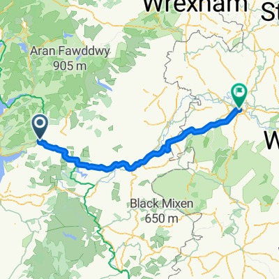
actual route for wrt2010
Since I arrived by train, I actually started cycling from Caersws station, staying over Friday night at Llanidloes campsite and riding up to Pennant via Hafren Forest the following morning for a midday start.
This also meant I ended up not travelling all the way back to the farm, but heading straight back Llangurig -> Lanidloes -> Caersws around monday noon. Still a loop, but did some of the end riding at the start. :-)
- -:--
- Duration
- 159.3 km
- Distance
- 1,630 m
- Ascent
- 1,630 m
- Descent
- ---
- Avg. speed
- ---
- Max. altitude

Route quality
Waytypes & surfaces along the route
Waytypes
Track
52.6 km
(33 %)
Quiet road
47.8 km
(30 %)
Surfaces
Paved
23.9 km
(15 %)
Unpaved
22.3 km
(14 %)
Asphalt
23.9 km
(15 %)
Gravel
20.7 km
(13 %)
Route highlights
Points of interest along the route
Accommodation after 9.4 km
Checkpoint 10 - Gully
Accommodation after 20.6 km
Checkpoint 12 - Foodbridge
Point of interest after 32.4 km
Missed the bridleway turning here (wasn't marked as bw)
Accommodation after 36.1 km
Checkpoint 13 - Nant Syddion Bothy
Point of interest after 38.6 km
dead end here - locked gate
Accommodation after 63.6 km
Checkpoint 7 - Strata Florida Abbey
Point of interest after 65.1 km
Oops, took a wrong turn at Strata Florida.
Accommodation after 76.8 km
Checkpoint 5 - hidden bothy
Accommodation after 80 km
Checkpoint 1 - in the middle of a bog. Decided against this one in the end.
Point of interest after 80 km
Too boggy. gave up, resulting in quite a lot of road-based backtracking.
Accommodation after 109.8 km
Checkpoint 8
Accommodation after 118.6 km
Checkpoint 11 - Nant Rhys Bothy
Accommodation after 129.5 km
Checkpoint 9 - Llangurig
Continue with Bikemap
Use, edit, or download this cycling route
You would like to ride WRT 2010 or customize it for your own trip? Here is what you can do with this Bikemap route:
Free features
- Save this route as favorite or in collections
- Copy & plan your own version of this route
- Split it into stages to create a multi-day tour
- Sync your route with Garmin or Wahoo
Premium features
Free trial for 3 days, or one-time payment. More about Bikemap Premium.
- Navigate this route on iOS & Android
- Export a GPX / KML file of this route
- Create your custom printout (try it for free)
- Download this route for offline navigation
Discover more Premium features.
Get Bikemap PremiumFrom our community
Other popular routes starting in Machynlleth
 Machynlleth to Aberystwyth
- Distance
- 33 km
- Ascent
- 503 m
- Descent
- 417 m
- Location
- Machynlleth, Wales, United Kingdom
 WRT 2010
- Distance
- 159.3 km
- Ascent
- 1,630 m
- Descent
- 1,630 m
- Location
- Machynlleth, Wales, United Kingdom
 Mach to Shrews
- Distance
- 100.4 km
- Ascent
- 702 m
- Descent
- 652 m
- Location
- Machynlleth, Wales, United Kingdom
 231126 Traws Eryri Final Official 1/7/23
- Distance
- 195.3 km
- Ascent
- ---
- Descent
- ---
- Location
- Machynlleth, Wales, United Kingdom
 Llyn Clywedog Loop
- Distance
- 57.9 km
- Ascent
- 1,012 m
- Descent
- 1,012 m
- Location
- Machynlleth, Wales, United Kingdom
 LEJOG_D5low
- Distance
- 138.6 km
- Ascent
- 1,184 m
- Descent
- 1,126 m
- Location
- Machynlleth, Wales, United Kingdom
 LEJOG D5
- Distance
- 160.6 km
- Ascent
- 1,475 m
- Descent
- 1,417 m
- Location
- Machynlleth, Wales, United Kingdom
 Machynlleth Radfahren
- Distance
- 41.5 km
- Ascent
- 689 m
- Descent
- 557 m
- Location
- Machynlleth, Wales, United Kingdom
Open it in the app