

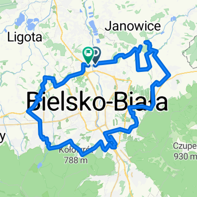
Beskid Mały Pętla
A cycling route starting in Bielsko-Biala, Silesian Voivodeship, Poland.
Overview
About this route
- -:--
- Duration
- 81.5 km
- Distance
- 1,446 m
- Ascent
- 1,444 m
- Descent
- ---
- Avg. speed
- ---
- Max. altitude

Route quality
Waytypes & surfaces along the route
Waytypes
Road
36.7 km
(45 %)
Quiet road
13.9 km
(17 %)
Surfaces
Paved
77.4 km
(95 %)
Unpaved
0.8 km
(1 %)
Asphalt
76.6 km
(94 %)
Paved (undefined)
0.8 km
(1 %)
Continue with Bikemap
Use, edit, or download this cycling route
You would like to ride Beskid Mały Pętla or customize it for your own trip? Here is what you can do with this Bikemap route:
Free features
- Save this route as favorite or in collections
- Copy & plan your own version of this route
- Split it into stages to create a multi-day tour
- Sync your route with Garmin or Wahoo
Premium features
Free trial for 3 days, or one-time payment. More about Bikemap Premium.
- Navigate this route on iOS & Android
- Export a GPX / KML file of this route
- Create your custom printout (try it for free)
- Download this route for offline navigation
Discover more Premium features.
Get Bikemap PremiumFrom our community
Other popular routes starting in Bielsko-Biala
 BB - Pszczyna - BB
- Distance
- 53.5 km
- Ascent
- 2,694 m
- Descent
- 2,708 m
- Location
- Bielsko-Biala, Silesian Voivodeship, Poland
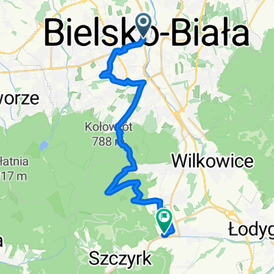
 bb - koniaków - żywiec - bb
- Distance
- 102.3 km
- Ascent
- 1,410 m
- Descent
- 1,400 m
- Location
- Bielsko-Biala, Silesian Voivodeship, Poland
 klrkuy cam klrkuy bugün tam
- Distance
- 9.5 km
- Ascent
- 538 m
- Descent
- 51 m
- Location
- Bielsko-Biala, Silesian Voivodeship, Poland
 chrobacza łąka
- Distance
- 67.1 km
- Ascent
- 930 m
- Descent
- 930 m
- Location
- Bielsko-Biala, Silesian Voivodeship, Poland
 Bielsko-biała
- Distance
- 58.7 km
- Ascent
- 735 m
- Descent
- 727 m
- Location
- Bielsko-Biala, Silesian Voivodeship, Poland
 04.05.2013_Bb-Janowice-Pisarzowice-Kozy BB
- Distance
- 25.9 km
- Ascent
- 220 m
- Descent
- 220 m
- Location
- Bielsko-Biala, Silesian Voivodeship, Poland
 Bielsko-Biała → Buczkowice (Velo Biała / DW942) - Velo Biała: Bielsko → Buczkowice
- Distance
- 21.5 km
- Ascent
- 756 m
- Descent
- 629 m
- Location
- Bielsko-Biala, Silesian Voivodeship, Poland
 Dookoła wielkich jezior
- Distance
- 50.7 km
- Ascent
- 202 m
- Descent
- 208 m
- Location
- Bielsko-Biala, Silesian Voivodeship, Poland
Open it in the app