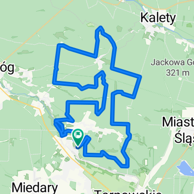
toszek wielowies
- 70.7 km
- 335 m
- 336 m
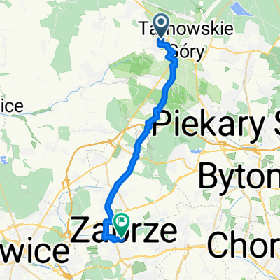
- Tarnowskie Góry, Silesian Voivodeship, Poland
A cycling route starting in Tarnowskie Góry, Silesian Voivodeship, Poland.
Overview
created this 6 years ago
Route quality
Track
12.5 km
(45 %)
Quiet road
7.5 km
(27 %)
Paved
10 km
(36 %)
Unpaved
15.3 km
(55 %)
Asphalt
9.7 km
(35 %)
Gravel
5.3 km
(19 %)
Continue with Bikemap
You would like to ride Świerklaniec - Ossy or customize it for your own trip? Here is what you can do with this Bikemap route:
Free trial for 3 days, or one-time payment. More about Bikemap Premium.
Discover more Premium features.
Get Bikemap PremiumFrom our community
Open it in the app