

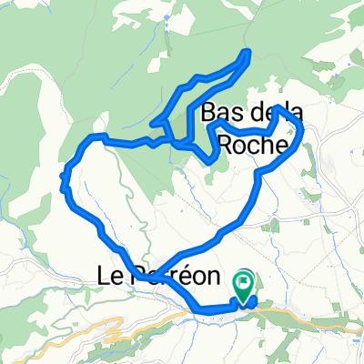
Per's to Col de Truges
A cycling route starting in Le Perréon, Auvergne-Rhône-Alpes, France.
Overview
About this route
- -:--
- Duration
- 19.3 km
- Distance
- 373 m
- Ascent
- 198 m
- Descent
- ---
- Avg. speed
- ---
- Max. altitude

Route quality
Waytypes & surfaces along the route
Waytypes
Road
12.7 km
(66 %)
Quiet road
6.2 km
(32 %)
Undefined
0.4 km
(2 %)
Surfaces
Paved
6.9 km
(36 %)
Asphalt
6.9 km
(36 %)
Undefined
12.3 km
(64 %)
Continue with Bikemap
Use, edit, or download this cycling route
You would like to ride Per's to Col de Truges or customize it for your own trip? Here is what you can do with this Bikemap route:
Free features
- Save this route as favorite or in collections
- Copy & plan your own version of this route
- Sync your route with Garmin or Wahoo
Premium features
Free trial for 3 days, or one-time payment. More about Bikemap Premium.
- Navigate this route on iOS & Android
- Export a GPX / KML file of this route
- Create your custom printout (try it for free)
- Download this route for offline navigation
Discover more Premium features.
Get Bikemap PremiumFrom our community
Other popular routes starting in Le Perréon
 St Marie-Sabliere
- Distance
- 12.7 km
- Ascent
- 369 m
- Descent
- 372 m
- Location
- Le Perréon, Auvergne-Rhône-Alpes, France
 Per's to M-a-V
- Distance
- 23.9 km
- Ascent
- 222 m
- Descent
- 270 m
- Location
- Le Perréon, Auvergne-Rhône-Alpes, France
 Per's to Chatillon (Domaine Chasselay)
- Distance
- 29.2 km
- Ascent
- 307 m
- Descent
- 393 m
- Location
- Le Perréon, Auvergne-Rhône-Alpes, France
 Per's to Ville sur Jarnioux
- Distance
- 19.4 km
- Ascent
- 337 m
- Descent
- 224 m
- Location
- Le Perréon, Auvergne-Rhône-Alpes, France
 Per's to Col de Truges
- Distance
- 19.3 km
- Ascent
- 373 m
- Descent
- 198 m
- Location
- Le Perréon, Auvergne-Rhône-Alpes, France
 TE_2017_Dijon_Lyon_3
- Distance
- 136.2 km
- Ascent
- 2,047 m
- Descent
- 2,085 m
- Location
- Le Perréon, Auvergne-Rhône-Alpes, France
 De 255 Chemin du Vallon, Le Perréon à 305 Chemin du Vallon, Le Perréon
- Distance
- 18.8 km
- Ascent
- 511 m
- Descent
- 513 m
- Location
- Le Perréon, Auvergne-Rhône-Alpes, France
 Per's to Morgon
- Distance
- 14.1 km
- Ascent
- 185 m
- Descent
- 190 m
- Location
- Le Perréon, Auvergne-Rhône-Alpes, France
Open it in the app