

Geretsried-Schlehdorf
A cycling route starting in Geretsried, Bavaria, Germany.
Overview
About this route
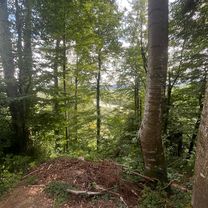
Geretsried, Jahnstr. (P-Eisstadion)
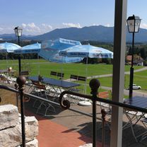
Landgasthaus Fischerwirt, Schlehdorf
9 - 11 PM no day off
- -:--
- Duration
- 76.6 km
- Distance
- 310 m
- Ascent
- 308 m
- Descent
- ---
- Avg. speed
- ---
- Max. altitude

Route quality
Waytypes & surfaces along the route
Waytypes
Quiet road
26 km
(34 %)
Track
23 km
(30 %)
Surfaces
Paved
56.7 km
(74 %)
Unpaved
12.2 km
(16 %)
Asphalt
52.1 km
(68 %)
Gravel
9.2 km
(12 %)
Route highlights
Points of interest along the route
Accommodation after 37.7 km
Fischerwirt
Continue with Bikemap
Use, edit, or download this cycling route
You would like to ride Geretsried-Schlehdorf or customize it for your own trip? Here is what you can do with this Bikemap route:
Free features
- Save this route as favorite or in collections
- Copy & plan your own version of this route
- Sync your route with Garmin or Wahoo
Premium features
Free trial for 3 days, or one-time payment. More about Bikemap Premium.
- Navigate this route on iOS & Android
- Export a GPX / KML file of this route
- Create your custom printout (try it for free)
- Download this route for offline navigation
Discover more Premium features.
Get Bikemap PremiumFrom our community
Other popular routes starting in Geretsried
 Alpenstraße, Geretsried nach Alpenstraße, Geretsried
- Distance
- 33.6 km
- Ascent
- 254 m
- Descent
- 261 m
- Location
- Geretsried, Bavaria, Germany
 Geretsried - Holzwirt Ascholding
- Distance
- 21.3 km
- Ascent
- 228 m
- Descent
- 220 m
- Location
- Geretsried, Bavaria, Germany
 Geretsried-Schlehdorf
- Distance
- 76.6 km
- Ascent
- 310 m
- Descent
- 308 m
- Location
- Geretsried, Bavaria, Germany
 Geretsried - Schützenwirt Ellbach - Märzenhof Nantesbuch - Geretsried
- Distance
- 64.7 km
- Ascent
- 378 m
- Descent
- 409 m
- Location
- Geretsried, Bavaria, Germany
 Geretsried - Cafe Freizeit Bairawies - Eulenschwang - Geretsried
- Distance
- 51.3 km
- Ascent
- 581 m
- Descent
- 628 m
- Location
- Geretsried, Bavaria, Germany
 Geretsried - Gasthof Fischbach - Geretsried
- Distance
- 49.5 km
- Ascent
- 454 m
- Descent
- 491 m
- Location
- Geretsried, Bavaria, Germany
 Geretsried - Kloster Reutberg - Bad Tölz - Geretsried
- Distance
- 56.6 km
- Ascent
- 581 m
- Descent
- 581 m
- Location
- Geretsried, Bavaria, Germany
 Geretsried - Moralt Alm Tölz - Greiling - Geretsried
- Distance
- 62.2 km
- Ascent
- 530 m
- Descent
- 581 m
- Location
- Geretsried, Bavaria, Germany
Open it in the app