

Wein4tel Gravel 200
A cycling route starting in Leobendorf, Lower Austria, Austria.
Overview
About this route
Gravelrunde - ausschließlich auf den WV-Radrouten
(Sagenhaft - rund um die Burg Kreuzenstein / Weinviertel-Donau Radtour / Kreuttalroute / Zweigelt / Sylvaner / Veltliner Radtour / Welschriesling / Kamp-Thaya-March-Radroute / Muskateller / Traminer / OMV Erlebnisradweg / Dampfroß und Drahtesel / Rund um den Bisamberg
- -:--
- Duration
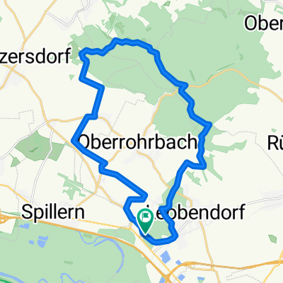
- 218.1 km
- Distance
- 719 m
- Ascent
- 761 m
- Descent
- ---
- Avg. speed
- ---
- Max. altitude

Route quality
Waytypes & surfaces along the route
Waytypes
Quiet road
115.6 km
(53 %)
Track
45.8 km
(21 %)
Surfaces
Paved
163.6 km
(75 %)
Unpaved
21.8 km
(10 %)
Asphalt
154.8 km
(71 %)
Gravel
19.6 km
(9 %)
Continue with Bikemap
Use, edit, or download this cycling route
You would like to ride Wein4tel Gravel 200 or customize it for your own trip? Here is what you can do with this Bikemap route:
Free features
- Save this route as favorite or in collections
- Copy & plan your own version of this route
- Split it into stages to create a multi-day tour
- Sync your route with Garmin or Wahoo
Premium features
Free trial for 3 days, or one-time payment. More about Bikemap Premium.
- Navigate this route on iOS & Android
- Export a GPX / KML file of this route
- Create your custom printout (try it for free)
- Download this route for offline navigation
Discover more Premium features.
Get Bikemap PremiumFrom our community
Other popular routes starting in Leobendorf
 Wein4tel Gravel 200
- Distance
- 218.1 km
- Ascent
- 719 m
- Descent
- 761 m
- Location
- Leobendorf, Lower Austria, Austria
 URB Enzersdorf it Porrau kurz kurz
- Distance
- 72.2 km
- Ascent
- 440 m
- Descent
- 437 m
- Location
- Leobendorf, Lower Austria, Austria
 B2B
B2B- Distance
- 22.5 km
- Ascent
- 64 m
- Descent
- 88 m
- Location
- Leobendorf, Lower Austria, Austria
 mtb | waschberg #1 - stundenrunde
- Distance
- 20.3 km
- Ascent
- 392 m
- Descent
- 391 m
- Location
- Leobendorf, Lower Austria, Austria
 mfk schönau
- Distance
- 84.6 km
- Ascent
- 55 m
- Descent
- 104 m
- Location
- Leobendorf, Lower Austria, Austria
 RCO 2015 Weinviertel 1. Tag
- Distance
- 82.4 km
- Ascent
- 202 m
- Descent
- 208 m
- Location
- Leobendorf, Lower Austria, Austria
 Unterrohrbach Manhartsbrunn Enzesfeld Kreutal Würnitz
- Distance
- 78 km
- Ascent
- 707 m
- Descent
- 707 m
- Location
- Leobendorf, Lower Austria, Austria
 URB MarchfeldkanalRobert M
- Distance
- 31.3 km
- Ascent
- 4 m
- Descent
- 21 m
- Location
- Leobendorf, Lower Austria, Austria
Open it in the app